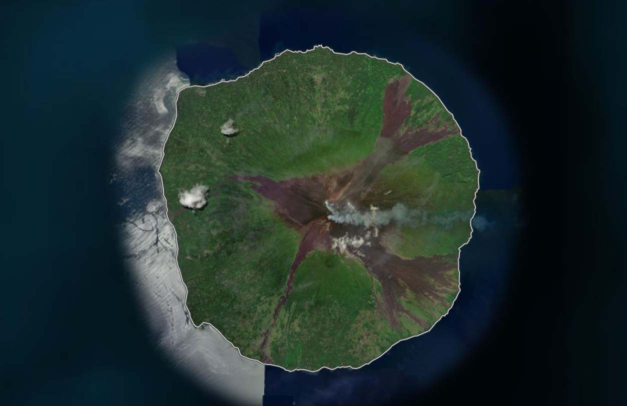
Manam is a 10 km wide volcanic island located in Papua New Guinea. It is one of the most active volcanoes in Guinea. Manam is a basaltic-andesitic stratovolcano and has one of the longest records of historic eruptions. While there is vegetation on its lower slopes, the upper slopes are bare due to frequent eruptions.
| Location: | Bismarck Sea, Bogia District, Papua New Guinea |
| Coordinates: | -4.061620, 145.027170 |
| Volcano Type: | Basaltic-andesitic stratovolcano |
Manam’s Location
Manam’s Latest Status
2026: Currently Erupting. Alert Level 2.
Manam’s Eruptive History
| 1996 | December – Major eruption – 13 people killed from pyroclastic flows. |
| 2004 | October-December – Major eruption saw 9,000 inhabitants of the island evacuated. 5 people died. |
| 2005 | Even larger eruption occurred, causing further injuries. Further evacuations took place. |
| 2007 | Eruption with ash plume reaching 12,000ft. A mudflow killed 4 people. |
| 2008 | Eruption with minor ash plume |
| 2010 | Ongoing eruptions causing pyroclastic flows. |
| 2012 | Eruption with small ash plumes. Strombolian activity and lava flow observed by locals. |
| 2013 | Eruption with ash plume reaching 13,000ft. Red glow seen from summit |
| 2015 | Large eruption with ash plume rising to over 36,000ft |
| 2016-2017 | Multiple ash advisories issues. |
| 2019 | Significant eruptions continue. An earthquake was observed two hours prior to major eruption with ash plumes reaching 55,000ft. Lava observable from satellite imagery. Water sources and food gardens completely destroyed |
| 2020 | Regular eruptions continue on Manam. On the 6th of December, an eruption occurred producing an ash plume to almost 3km. |
| 2021 | June: A small eruption occurred with an ash plume of 2km |
| 2022 | Larger eruptions continue. In April, a large eruption occurred, producing an ash plume to 14km |
| 2023 | November 2023: Significant eruptions, producing large fire fountaining and producing ash to 2000 meters. |
| 2024 | March: Eruption with plume rising to 3000m |
| 2025 | Manam maintained low-level unrest with intermittent ash plumes and persistent sulfur dioxide emissions detected by satellite. |
Manam Monitoring
Not available for this volcano.
Manam Images