- Home
- /
- Global Volcano Database
- /
- Indonesia Volcanoes
- /
- Mount Sirung
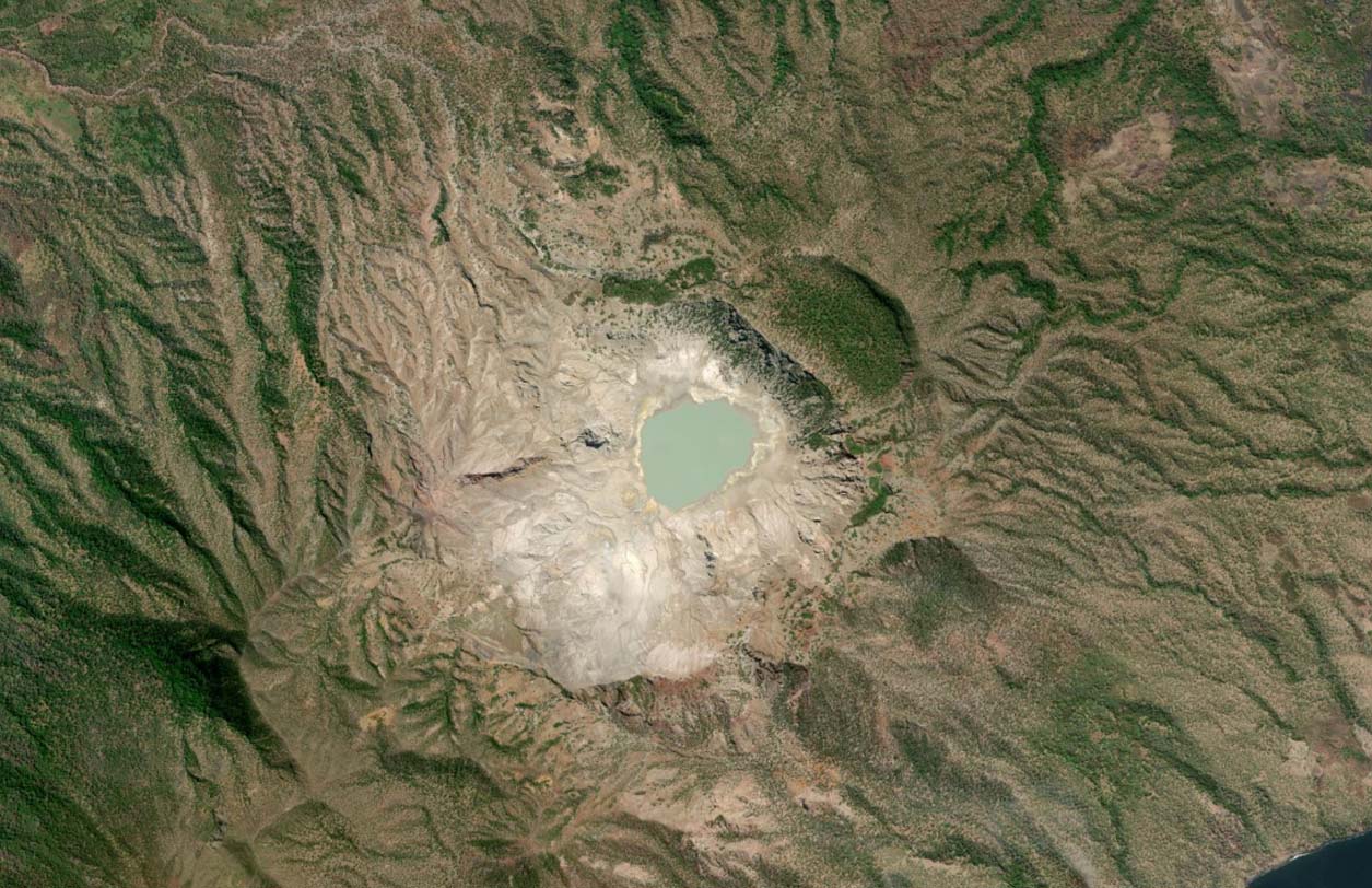
Mount Sirung is a frequently active volcano located on Pantar Island, Indonesia. It has a 2 km wide caldera with a large sulphurous crater lake. A number of phreatic eruptions have occurred from vents within the caldera.
| Location: | Pantar Island, Indonesia |
| Coordinates: | -8.515775, 124.133235 |
| Volcano Type: | Complex volcano |
Mount Sirung’s Location
Mount Sirung’s Latest Status
2026: Currently Alert Level 1.
Mount Sirungs’s Eruptive History
| 1934 | First confirmed eruption (VEI=2). Ash fall in local villages. |
| 1960 | Eruption in March (VEI=2) |
| 1964-65 | Two small eruptions occurred, both of VEI=1 |
| 2012 | May. Eruption occurred lasting three hours. Incandescent material ejected and ash column to 3.5km. Four days later, a further eruption occurred with ash rising to 3km. The Alert Level to upgraded to 3 and an exclusion zone set up. |
| 2015 | Eruption with Darwin VAAC confirming an ash plume to 1.5km. A further eruption occurred one day later. |
| 2021 | PVMBG reported that a phreatic eruption occurred, producing an ash plume to 2000m. |
| 2022 | PVMBG reported that white emissions rose from the crater. Seismicity remains low however. |
Mount Sirung Monitoring
For monitoring of Indonesian Volcanoes, please refer to PVMBG.
Mount Sirung Images
- Home
- /
- Global Volcano Database
- /
- Indonesia Volcanoes
- /
- Mount Sirung