
Severe Tropical Cyclone Vaianu first formed as a tropical disturbance on April 5, 2026, in the waters north of Fiji and west of Samoa. As it tracked south-southeast through the South Pacific, it rapidly intensified into a Category 3 severe tropical cyclone, reaching its peak intensity on April 7 with sustained winds of approximately 185 km/h. Even as it moved into cooler waters and transitioned into an extratropical system, it remained a formidable storm, eventually making landfall on New Zealand’s Maketu Peninsula on April 12. During its peak and subsequent impact, it brought destructive gusts exceeding 130 km/h and heavy rainfall. This is our report.
Every chase begins the same way…hunched over weather models for hours, trying to squeeze out any clue of where the hammer is actually going to fall. It’s an exercise in frustration. Usually, the models don’t even agree sometimes a few hours before landfall (f they ever do), which makes choosing a destination feel like a complete gamble.
But this time, the data actually played ball. The initial models projected the system crossing just west of the Coromandel before carving a path down the North Island. Since most of the heavy rain was staying offshore, we knew we were looking at a wind event.
ECMWF’s Track
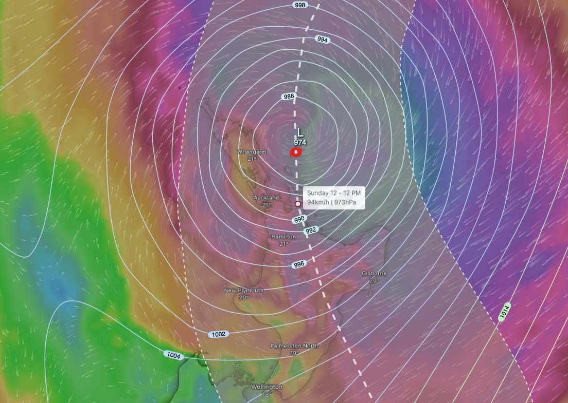
Two days out, all signs pointed to the eastern Coromandel. MetService even pulled the trigger on a Red Warning, which is the highest level possible. However, as the cyclone drew closer, the data changed. I noticed the track shifting further east, putting the Bay of Plenty right in the crosshairs. It looked like Whakatane, Ohope, and Opotiki were about to get the worst of it.
That left me with a massive dilemma. The Bay of Plenty was still sitting under a standard Orange warning. It’s a tough call to justify ignoring a Red warning region for an Orange one, especially when you’ve got to get it right.
Rather than committing too early, I packed the gear and hit the road toward Waihi on Saturday morning. I could then decide whether to push north into the Coromandel or pivot south toward the Bay. Perhaps MetService may upgrade the Bay of Plenty to Red at their 10am update.
I arrived into Waihi shortly after 10am and the Bay of Plenty was still orange. One final look at the latest models confirmed it…I had to go south. I made the call and high tailed it down to Whakatane. Almost the second I pulled in, MetService officially upgraded the region to a Red warning. About time!
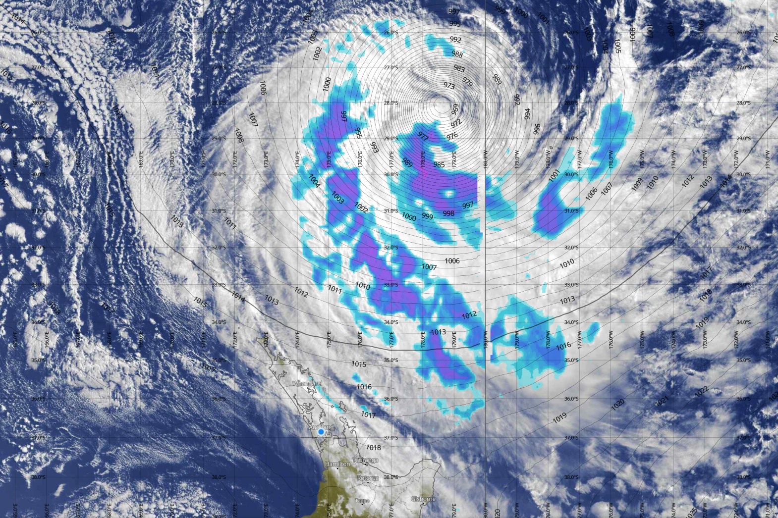
Satellite and rain radar of Vaianu approaching NZ
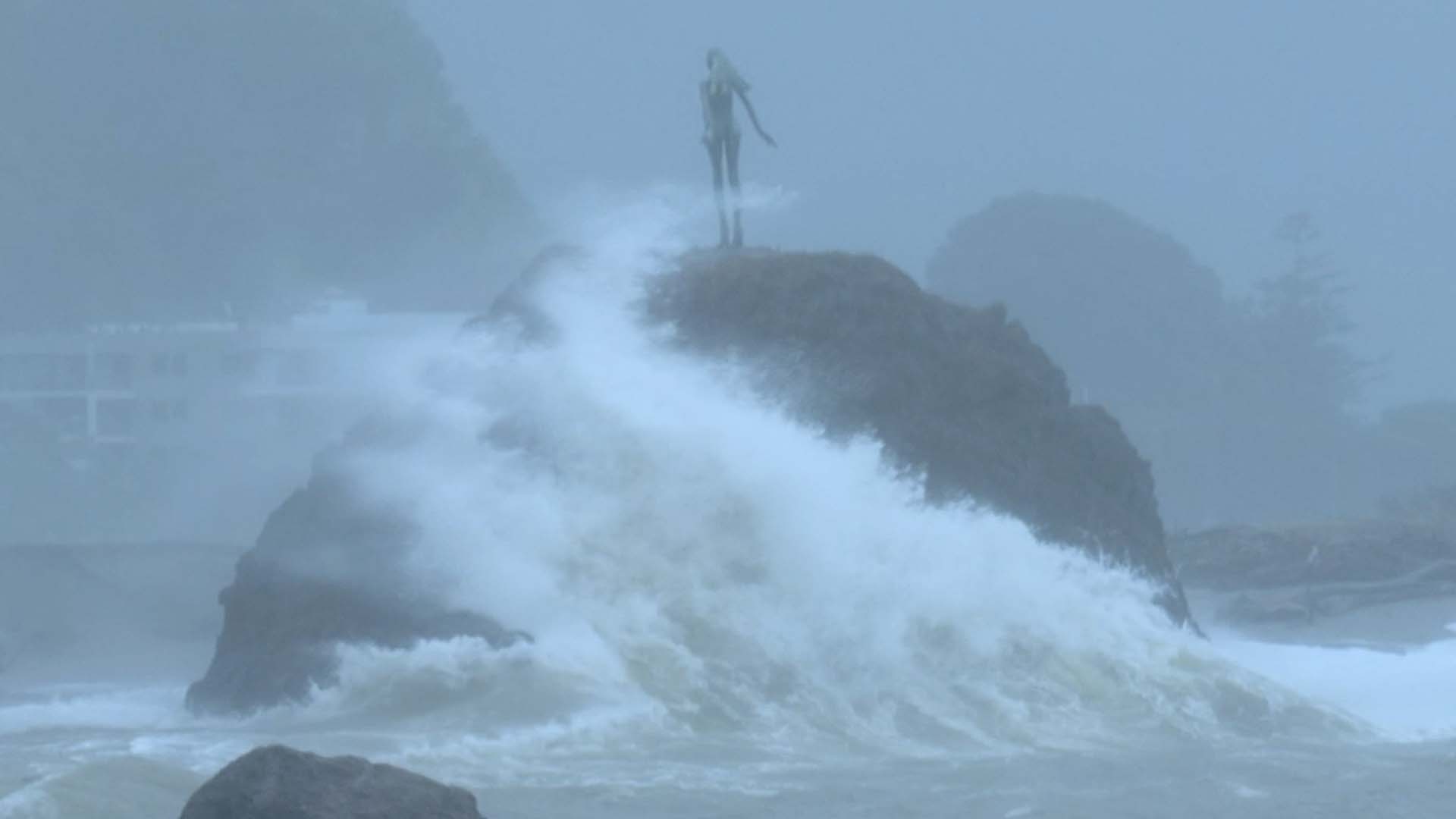
I quickly sorted a motel and made a beeline for the Whakatane Bar… not for a pre-storm beer – rather where the Whakatane river meets the ocean. It’s notorious for being one of the most dangerous water crossings in New Zealand. The wind hadn’t quite arrived yet, but the swell was already putting on a show. The waves were spectacular, and I counted about ten surfers out there making the most of the pre-cyclone conditions before things got truly ugly.
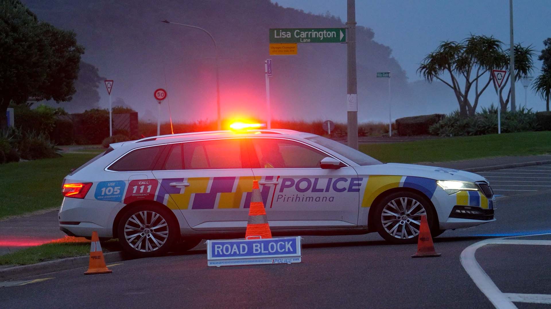
Just down the road at Ohope Beach, forced evacuations were already in full swing. Personally, I’ve never been a fan of the forced approach. I’m a firm believer in giving people the facts they need and letting them make their own calls as adults. But the decision had been made. The police had already set up roadblocks, sealing off some roads entirely.
That evening, the silence was very eerie. No wind, no birds, no traffic. Just a heavy quiet before the storm.
The next morning, I was up at 6am. The wind had already picked up and the trees outside were blowing quite violently. I met up with fellow chaser Geoff Mackley and we made final preparations for the chase. We headed back down to the bar and it found quite dramatic scenes. The waves were big and the wind was coming in quite violent gusts. It was pelting down with rain also.
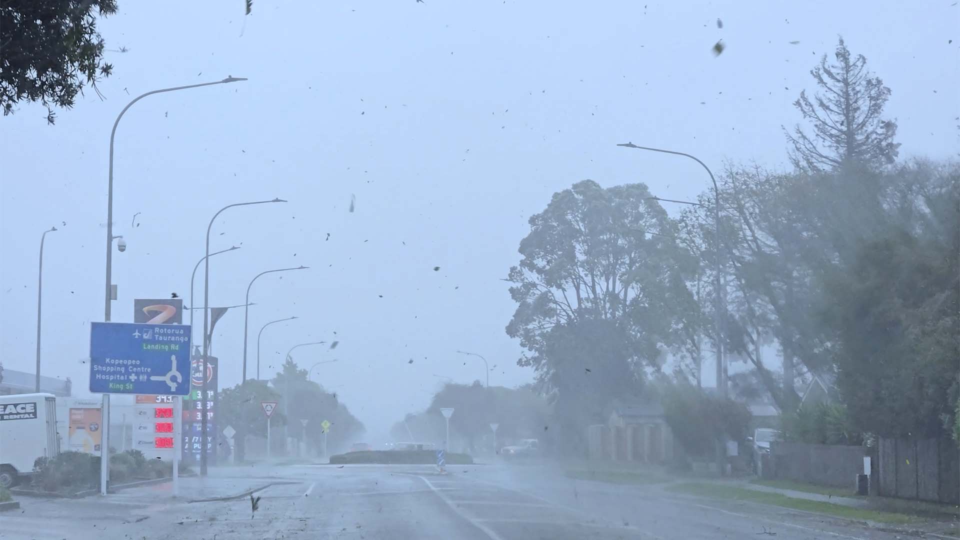
By 8.30am, the storm shifted up a gear. The wind began to hammer the area, and branches were snapping off trees all around us. It was finally time to gear up and get the helmet on.
By 10am, the situation had escalated to a full scale evacuation of Ohope. Officials were on the ground, ordering everyone to be out of the town by noon. Very intense gusts were smashing the coastline and town.
I got some great footage and quickly edited it up in the only cafe still open (Thanks to The Strand Cafe!). As I was editing, trees were coming down outside, shop signs were snapping and some windows smashed also. It was time to get back out there. But before I headed out, I had a quick look at the media reports. There wasn’t anything much happening in the Coromandel. All the headlines were in Whakatane. I had made the right decision, that’s for sure.
It was between 12-2pm when the storm reached its highest intensity. I measured gusts of 125km/hr. The wind was toppling trees left and right, and the rain had turned into a total deluge. It was absolute chaos and exactly where I wanted to be, right in the thick of it all.
Authorities were particularly concerned about the approaching high tide and ordered residents along Muriwai Drive to evacuate. Whilst the tide did reach the flood gates, thankfully no houses were inundated.
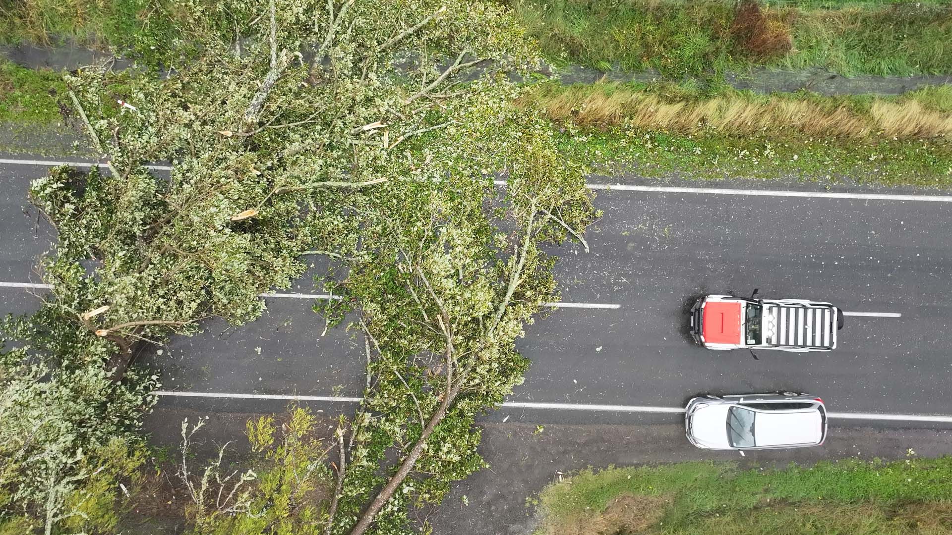
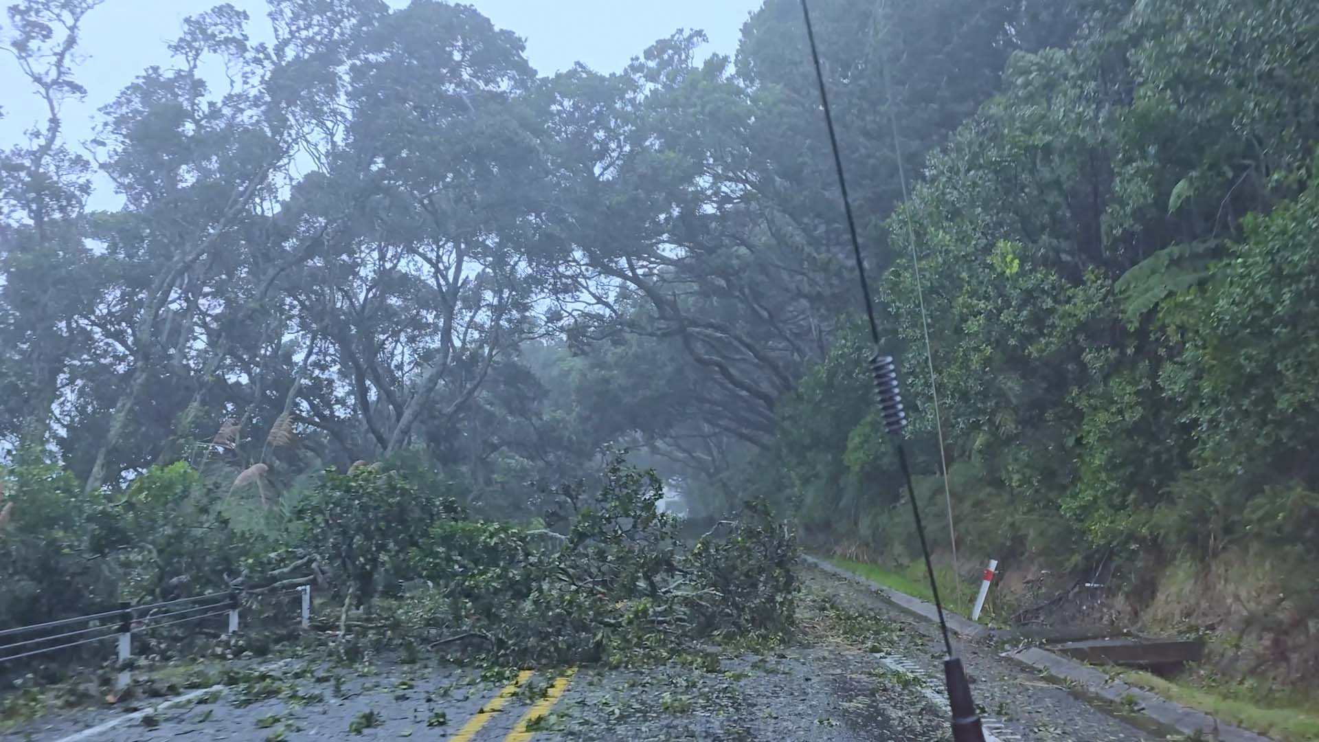
Just after 2pm and with the storm shifting further south-east we decided to follow it and drive down to Opotiki. We tried taking the inland route, but it didn’t take long to hit a wall of downed trees blocking the road. We had to return and try the coast road instead. It was pure mayhem. Trees were down everywhere, and the paddocks had been transformed into miniature oceans, with the wind actually whipping up sizeable waves across the flooded farmland. Homes were flooded.
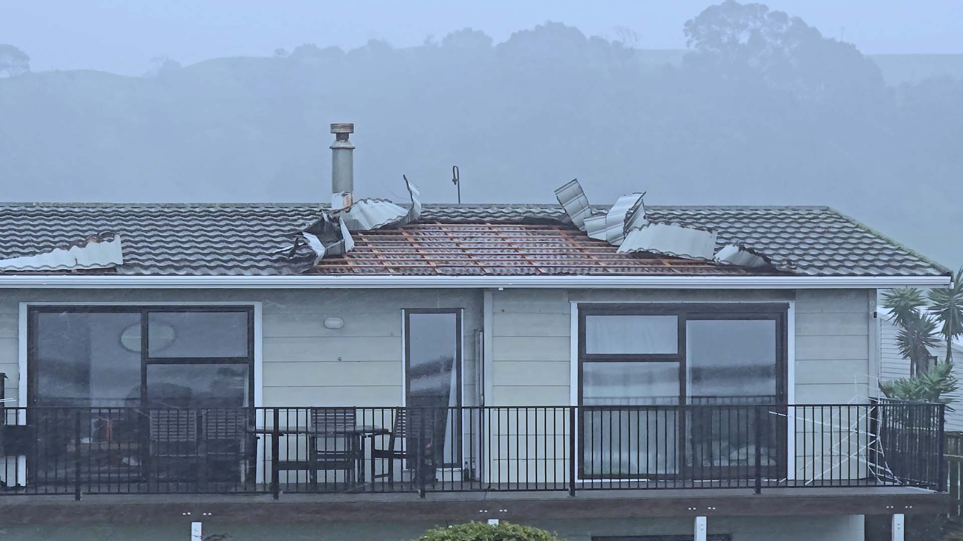
The little settlement at Waiotahe Beach was taking a brutal beating. I saw one house where the roof tiles had been peeled back like paper. This was where the wind felt the worst. Unlike the surging gusts in Whakatāne, this was a relentless, sustained wind of nearly 100 km/h.
By the time we rolled into Opotiki, the wind was finally starting to lose its bite and a sign the worst of the storm was moving on. The power was out, and with the roads ahead a mess and closed, we’d gone as far as we could.
Cyclone Vaianu was fairly typical for an extratropical system reaching New Zealand. Unlike Cyclone Gabrielle, its speed prevented it from lingering long enough to cause catastrophic damage.
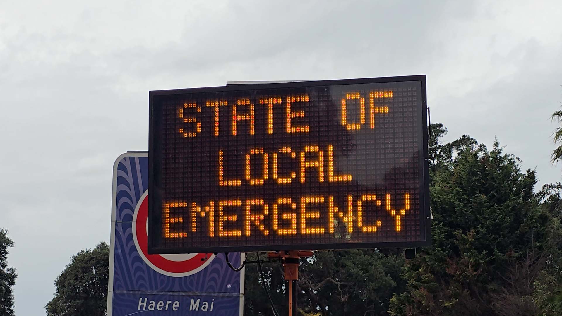
Because many regions saw little to no impact, public frustration grew regarding the media hype and the Red Warnings that seemed disproportionate to the actual event. There is a strong argument for establishing standardised, objective criteria that councils must meet before declaring a State of Emergency. An Orange Warning, for instance, should likely not be a sufficient trigger for such a serious legal declaration.