Over the past decade, I have maintained a comprehensive observational record of Ambrym Volcano in Vanuatu, documenting an extraordinary period of volcanic transformation. My archive represents the most detailed collection of observations, data, imagery, and video footage spanning this timeframe.
Ambrym’s geographic isolation has kept it largely invisible to the mainstream. Despite being a truly unique volcanic system, few researchers have ever set foot on the island, and dedicated scientific publications remain scarce. This neglect is particularly unfortunate given the volcano’s exceptional characteristics.
Access challenges have intensified following Air Vanuatu’s bankruptcy, which grounded all commercial flights and created significant logistical barriers. Currently, a single weekly flight serves the route, though cancellations are frequent and securing bookings requires local connections and considerable persistence. With my last visit in June 2023, the time had come to return.
Even before landing, Air Vanuatu’s reliability issues surfaced once again, with three separate flight change notifications arriving the day before departure. At one point, their system had us departing after we were supposed to arrive. That one took multiple calls to customer service to resolve. Despite these initial complications, the actual flight proceeded smoothly until our approach to Craig Cove, where landing remains a nerve-wracking experience. The runway’s deteriorating patchwork of uneven grass, loose sand, and World War II-era tarmac seems to worsen with each visit.


Craig Cove airport, originally opened in 1979, had received a fresh coat of yellow paint and buzzed with the usual activity when I flight arrives. After purchasing bottled water, we began the truck journey along the southern coast toward Port Vatu.
Would you like any undies with your purchase? Shopping in Craig Cove

The road had changed since my previous visit. Multiple cyclones had inflicted considerable damage, forcing numerous detours where entire sections had collapsed into small valleys. Even our 4×4 struggled through certain parts. After an hour of challenging terrain, we reached Port Vatu, where my longtime friend John welcomed us warmly. Our friendship spans many years, and his assistance has been vital.

Ambrym’s weather patterns remain notoriously unpredictable. The coastal villages might bask in sunshine while the summit endures torrential downpours. The first three days brought persistently poor conditions, forcing us to postpone our summit attempt until clearer weather arrived.
Port Vatu village appeared largely unchanged, populated by the same friendly faces and shy children I remembered. However, the community had acquired powerful…or should I say terribly annoying bluetooth speakers that now provided a near 24-hour soundtrack. One particularly sleepless morning, I traced the source of this musical assault to a large speaker in an abandoned building which was completely unattended. The absurdity of the situation left me wondering WHY? Just why?!

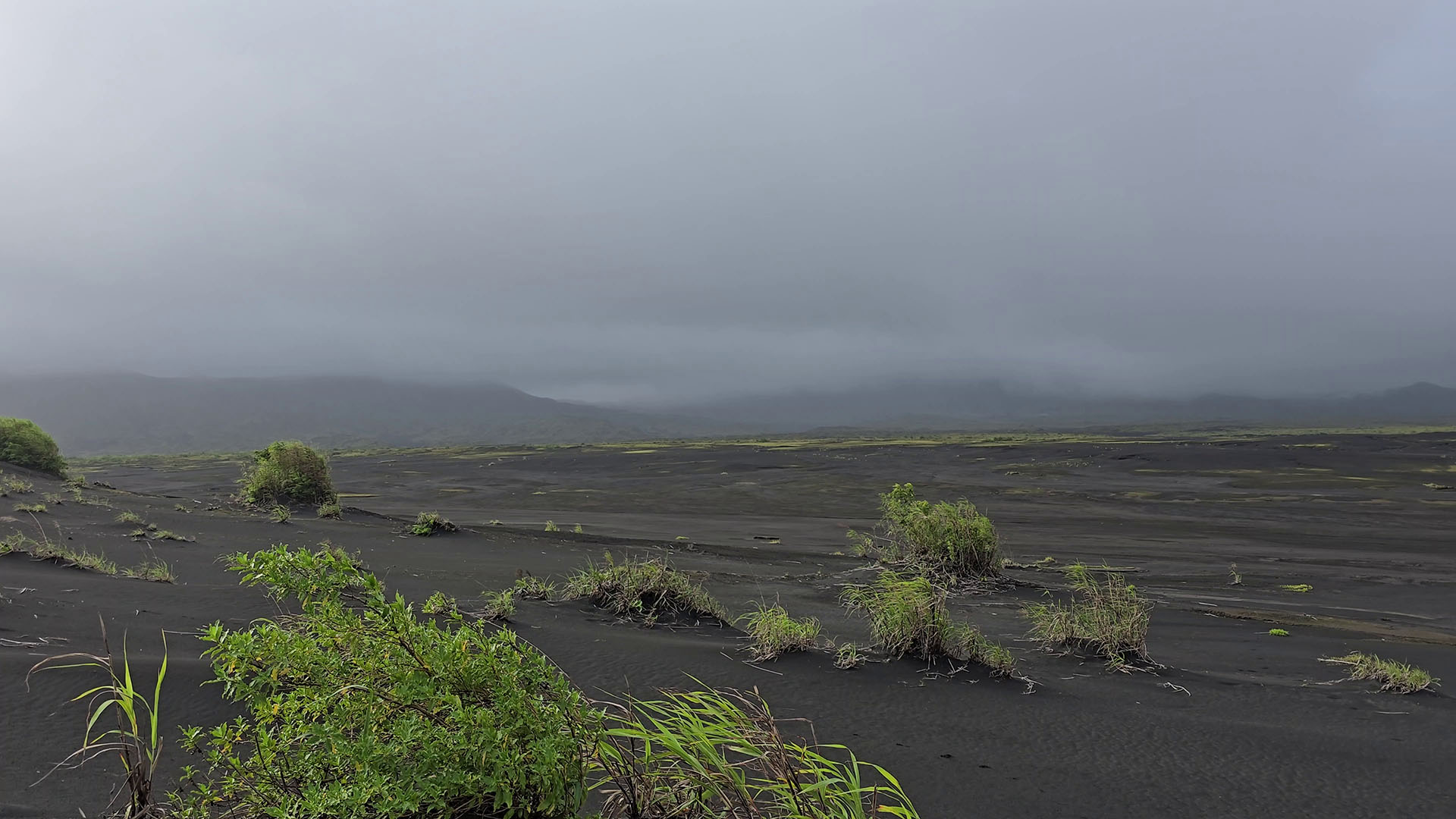
With three days to spare, Port Vatu’s beach is the place to be. During my previous visits, locals had expressed serious concerns about rising sea levels and accelerating coastal erosion. Remarkably, the landscape had transformed completely. The most recent cyclone had deposited vast quantities of black volcanic sand, extending the shoreline by roughly 100 meters. The community had already begun planting trees on this newly formed land, attempting to stabilise the land.
Playing football with the local kids on the newly formed beach

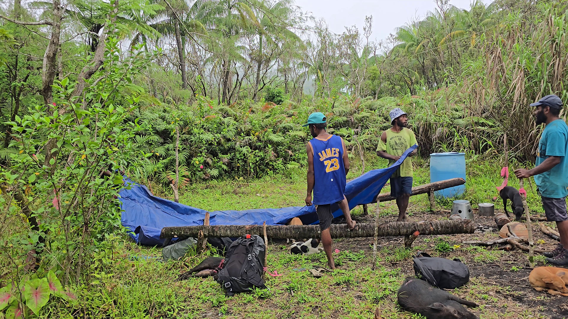
The waiting crawled by, but eventually clear skies emerged and we made a decision to trek to the summit. The expedition required substantial logistics: twelve porters, one guide, and approximately twenty-five hunting dogs. The first part of the trek is by truck which took us through flat jungle terrain and up a dried riverbed, shaving 45 minutes off the walking time. Previously, vehicles could go further, but post-cyclone damage had rendered the upper riverbed impassable.
The summit trek ranks among Vanuatu’s finest hiking experiences, beginning with a manageable walk through the 1913/1914 lava flows with some jungle sections. The biodiversity is spectacular – enormous ferns, massive taro leaves, vibrant dragonflies, and striking yellow-and-red spiders are everywhere. However, Ambrym has a big tick problem that demands serious precautions. Shorts are an absolute; long pants tucked into socks are essential, along with frequent inspections every few minutes during jungle passages. I counted at least ten ticks ascending our legs, and discovered one crawling up my companion’s neck. Fortunately, none had begun feeding. The locals casually removed them without concern, claiming that tick-borne illness is unknown on the island – though I wouldn’t recommend testing this assertion.


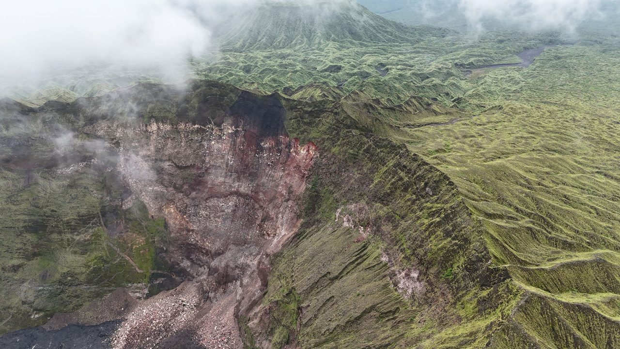
As we ascended, trail conditions deteriorated dramatically. Our guide Dick explained that no one had used this route recently, leaving sections completely overgrown. At one point, he carved an entirely new path with his machete, significantly slowing our progress. Elsewhere, cyclone-felled palm trees blocked the trail entirely. After five arduous hours, we finally reached West Camp, positioned directly on the caldera rim.
The camp’s condition was sad. Without prior knowledge, no one would recognise it as a former base camp. Complete overgrowth had reclaimed what was once a great camping spot filled with man memories. When the lava lakes were active it had an actual building, porter shelter, water tank, and toilet. Now, literally nothing remained.
Ambrym’s West Camp – not much here remains
We erected our tents amid ticks crawling across the fabric – an unpleasant discovery that hadn’t been problematic during previous visits. The cessation of major volcanic activity has likely created more favorable conditions for these parasites to flourish.
The weather wasn’t great with dark clouds and fog obscuring both Marum and Benbow cones. Strong winds and generally unpleasant conditions convinced us to postpone any further trekking until the next day.
The following day brought dramatic improvement – brilliant blue skies. In approximately six months of cumulative time on Ambrym, I had never witnessed such exceptional clarity. We were extraordinarily fortunate. Approaching Benbow crater, I was struck by remarkable changes within the caldera itself. During the active lava lake period, the area supported modest orchids, small ferns, and moss. My previous visit had revealed flourishing moss and ferns creating a green carpet across sections of the caldera floor. This time, however, small trees had begun establishing themselves, bushes sprouted throughout, and in places the vegetation had grown so dense that navigation became challenging.
Blue sky on Ambrym. A rare sight…


Without significant eruptive activity in the coming years, I predict a new jungle ecosystem will colonise extensive portions of the caldera within the next decade. This location represents a botanist’s paradise that urgently requires scientific study and documentation. While I’ve attempted to record these changes over the years, I’m a volcano guy – this botanical transformation deserves specialised expertise.
The trek from West Camp to Benbow’s summit took just over an hour. Having an experienced local guide proved essential as the route can be very disorientating, and a wrong turn could result in a catastrophic fall down unstable slopes.

Upon reaching Benbow’s rim, fog rolled in, though fortunately the crater interior remained visible. The changes since my last visit were striking and extensive.

The northern and southern ash plains continue experiencing rapid erosion, developing distinct stepped gullies and ridges as rainwater channels into increasingly pronounced drainage patterns. These plains had previously been protected by an inner tephra ring, but following the 2018 events, that protective barrier collapsed inward, exposing the ash deposits to relentless erosion. I anticipate this degradation will accelerate, eventually triggering the complete collapse of both plains. Landslide activity is particularly pronounced along the western crater walls.


During my previous visit, a fresh eruption had constructed a small cinder cone in the crater’s northern section, accompanied by modest lava flows. Since then, two additional eruptions occurred – most recently in November 2024, with an earlier event in January 2024. These eruptions generated substantially more lava than the single post-2018 eruption of April 2022. The accumulated fresh material has raised the crater floor by approximately 20-30 meters in places, reducing the overall depth to 250 meters.
My observations identify four distinct vents responsible for recent tephra and lava production. The northeastern vent appears to be one of the primary active sources, likely the same location that formed the 2022 cone and previously hosted the “son of Benbow” lava lake before 2018. A second vent, also in the northwestern sector, represents the largest of the four and has ejected considerable tephra deposits.
The NW vent, Benbow Crater.

Two additional vents occupy the southern crater section. One, positioned roughly where the main lava lake once existed, has produced rough, jagged, fragmented basaltic lava. The constant movement of still-molten material beneath a solidifying crust has torn the surface into sharp, broken textures. This vent maintains vigorous degassing and has deposited vibrant yellow and red sulfur minerals around its margins.

The fourth vent presents particular interest. Located within the southern ash plain, it initially appeared as simple fumarolic activity until closer inspection revealed an active vent with associated lava flows, positioned precisely where we formerly established camp.

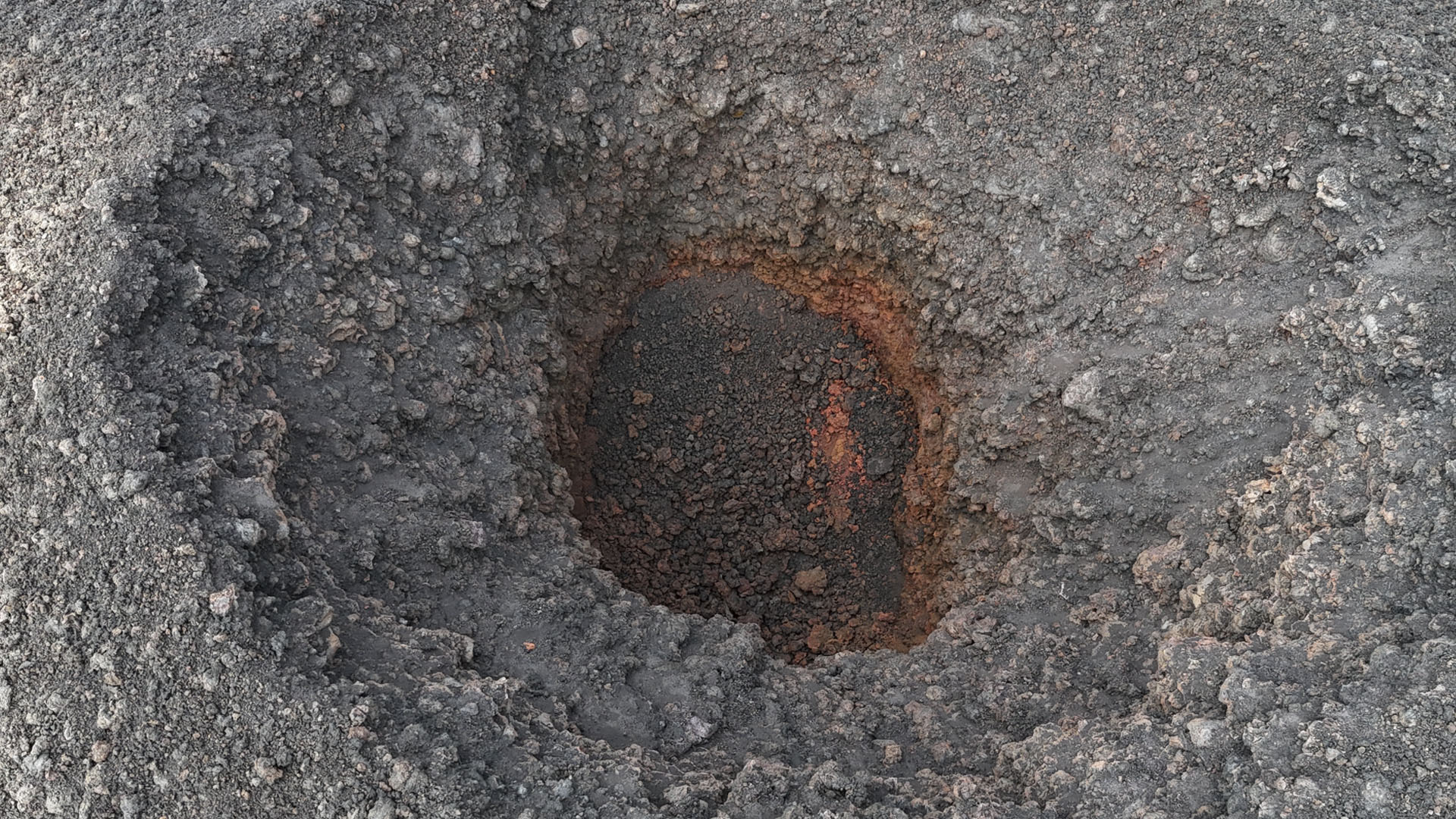
The entire lava field displays extensive fracturing, resulting from ground subsidence and thermal contraction processes. Numerous pit craters punctuate the flow field, probably formed when gas bubbles burst through still-molten lava. The orange coloration visible in pit crater depths indicates oxidised mineral deposits.

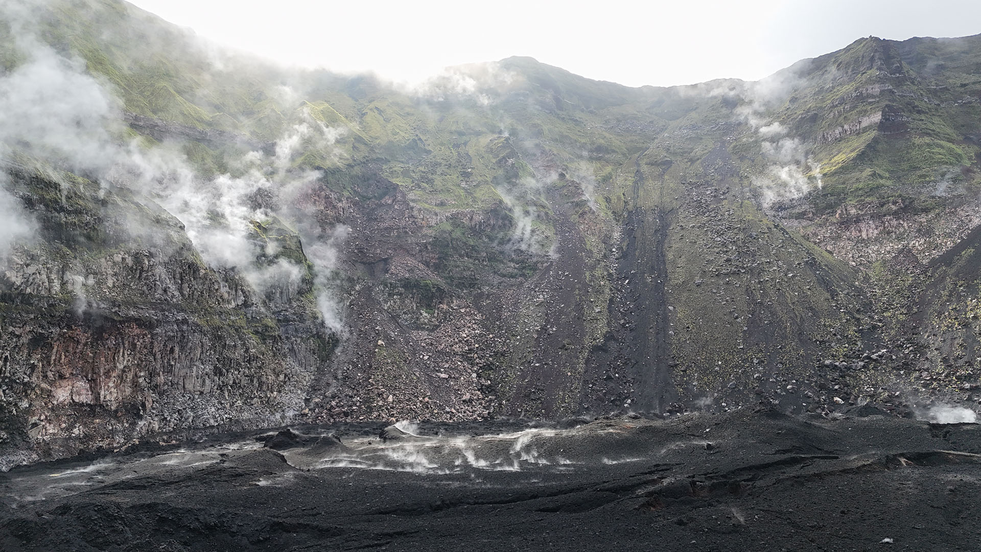
Vigorous fumarolic degassing occurs throughout multiple crater locations, creating an actively venting landscape.
The detection of thermal anomalies and vigorous degassing from a volcano’s crater floor indicates a shallow heat source and signifies an ongoing active volcanic system. Given the continued signs of activity, the potential for another effusive eruption within Benbow’s cone remains elevated.
Descending from Benbow’s cone, we hiked towards the collapse pit of Mbogon Niri Mbwelesu (Taten). The landscape transformation was remarkable. Areas that were once barren wastelands, almost always shrouded in noxious gases and posing extreme hazards, was now covered in vibrant green vegetation. The small lake on the southwestern flank of Marum’s cone remains intact.


Before 2018, Mbogon Niri Mbwelesu (Taten) crater occasionally hosted a small lava lake and exhibited Strombolian activity. Locals dubbed it “smokey” due to its high SO₂ and water vapor emissions. The events of 2018 approximately doubled the crater’s dimensions through massive subsidence and extensive landslide activity.
Previously, dense gas emissions rendered crater observation extremely challenging. However, the significantly reduced gas output now allows clear visual access into the crater. Approaching the crater should only be done with extreme caution, as the terrain remains highly unstable with numerous collapses and landslides occurring sporadically around the crater rim.
Post-2018 eruptive activity has resumed within this crater, originating from a single vent positioned in the south approximately two-thirds up the inner crater wall. This eruption generated a downhill flow that partially diverges before pooling at the crater base. Based on limited satellite imagery availability, this eruptive event likely occurred in April 2024, coinciding with Marum’s eruption period. The brief duration of this event is suggested by the absence of recent thermal anomalies, possibly due to cloud cover obscuring detection during the active phase.


The resulting lava flow is predominantly A’a, though the upper sections display exquisite ropey pahoehoe textures. This transition suggests the flow initiated as pahoehoe but underwent transformation as it descended, losing heat and increasing viscosity to form A’a flows. Notably, the upper flow sections have created several lava caves, though their exploration would require specialised rigging equipment. Current degassing from some cave entrances renders them unsafe for entry. Crater wall collapses have additionally exposed spectacular intrusion dikes.

Vent from the sky, showing potential lava tube


Exploration of the southern crater area revealed one of the few zones on Ambrym that has not experienced vegetative recovery. This region maintains significant volcanic activity, characterised by persistent water vapor and hydrogen sulfide degassing. Ongoing hydrothermal alteration processes continue from previous visits, generating diverse rock coloration ranging from deep grays and blacks to lighter tans and yellows. Ground temperatures remain notably elevated throughout this zone.


Our intended destination was Niri Mbwelesu, a crater within the Marum complex that previously hosted Strombolian eruptions and an active lava lake before 2018. A 2019 visit revealed a dramatically altered and hazardous landscape where multiple landslides occurred during my observations.
Severe erosion has rendered the existing access route impassable, preventing access to both Niri Mbwelesu and Marum’s main Mbwelesu crater. Despite attempting numerous alternative approaches – navigating some very steep gullies and precarious ridge systems my attempt was blocked by a formidable tephra cliff exceeding 20 meters. A potentially viable route might exist south of Mbogon Niri Mbwelesu (Taten), though such an expedition would likely require two or more days with uncertain prospects. Fortunately, optimal flying conditions enabled me to fly my drone over to both craters.
No way through to Marum’s two other craters.

Post-2018 volcanic activity at Niri Mbwelesu has generated a small volcanic cone and associated lava flows. Subsequent landslide activity has partially buried this cone, which displays distinctive white mineral deposits consistent with sulfate formations from acid-sulfate alteration processes. While some degassing activity persists, this crater currently exhibits the lowest activity levels among the complex. The contrast is profound when considering the vigorous lava lake that was here in the recent past.
Niri Mbwelesu Crater

Drone surveys successfully documented Marum’s extensive Mbwelesu crater. Although less active than neighboring Benbow, Marum’s most recent eruption occurred in April 2024, producing substantial lava flows and volcanic emissions.
The eastern crater section exhibits evidence of multiple distinct lava flow events occurring in separate eruptive phases. Two prominent vents are clearly identifiable, with the southwestern vent likely serving as the source for the most recent lava effusion. An extensive network of surface fractures and fissures creates complex patterns across the crater floor.
Mbwelesu Crater

Large landslide in Marum’s Mbwelesu Crater. Wonderful intrusion dikes can be seen in this image.

The western section of Mbwelesu has lava flow activity from at least two separate vents. One centrally positioned vent has constructed a small cone, while another vent occupies the northwestern crater wall. This western zone exhibits more pronounced degassing activity compared to the eastern section.

