When we landed on Hunga Tonga-Hunga Haʻapai back in 2016, we could have never foreseen that this unknown volcano in a remote stretch of the Pacific Ocean would be the site of one of the world’s biggest eruptions since Pinatubo – and make global headlines.
For a summary of events on Hunga Tonga-Hunga Haʻapai prior to 2016, please refer to our commentary here. This feature covers events post the 2015/16 eruption.
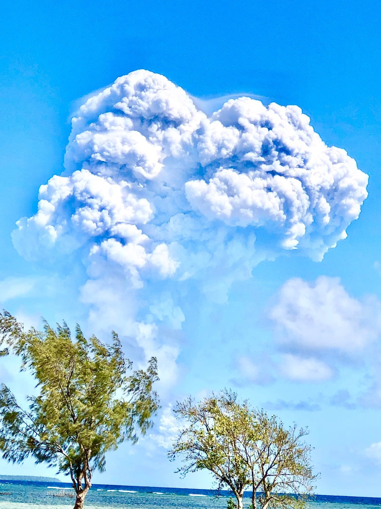
After having laid dormant since January 2015, Hunga Tonga-Hunga Haʻapai suddenly awoke once again on Dec 20 2021 at 11:02AM. VAAC Wellington reported a steam plume (without ash) rising to 6km. However, footage emerged shortly thereafter showing surtseyan surges, meaning new lava and material was being ejected.
Dec 20 eruption (Source: Unknown/Supplied)
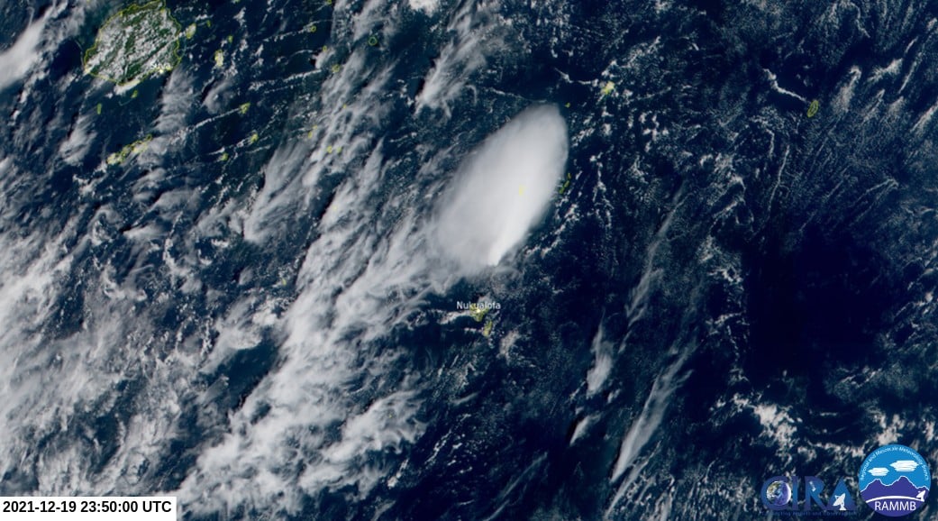
Dec 20 eruption from satellite (Source: RAMMB)
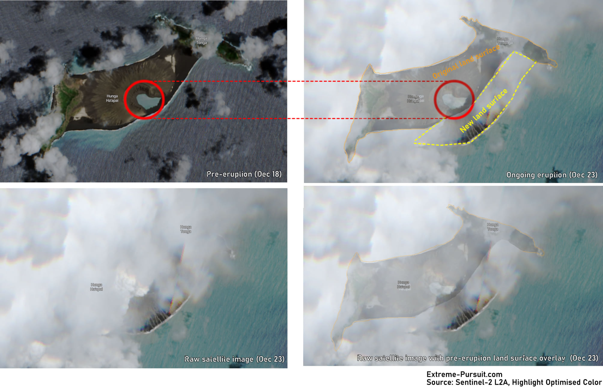
Surtseyan eruptions continued and on Dec 23, new satellite imagery confirmed the activity had added new land to the south of the existing island. The island was now estimated to be 75% larger. The 2014/15 vent was also filled in with a new vent opening less than 500 metres to the NE. This followed a similar pattern whereby each previous vent only erupted once.
On Dec 30, new footage released showed ever larger surtseyan eruptions and base surges continuing. Steam and ash plumes rose to over 12km high.
On the first day of 2022, Wellington VAAC reported a steam plume to 18km. Small eruptions continued until Jan 02, producing steam plumes. This image was captured on Jan 03 showed an expansion of the island to the south and a new vent present. It also showed the old 2014/5 vent filled in with ash. All vegetation on the original Hunga Tonga and Hunga Ha’apai islands was destroyed/covered in ash.

Source: Planet.com
Many experts believed this had brought an end to this phase of eruptive activity, with eruptions ceasing and emissions such as So2 decreasing also. This followed a similar pattern during the 2009 & 2014/15 eruptions.
On Jan 14 at 4:20PM, a new explosive eruption occurred, producing a steam plume to 17km and a lower ash plume to 3km. Data from GLD360 indicated lightning events at a rate of over 10,000/hr. Footage captured from the Tongan Navy showed surtseyan eruptions towering hundreds of metres high.
Residents on the island of Nuku’alofa noticed unusual tides and swells. Tonga issued a marine tsunami warning as a result. A small tsunami between 30-40cm high was generated.
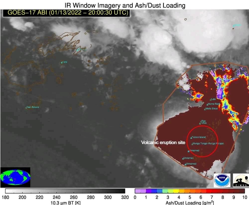
The ash cloud generated – Source: NOAA
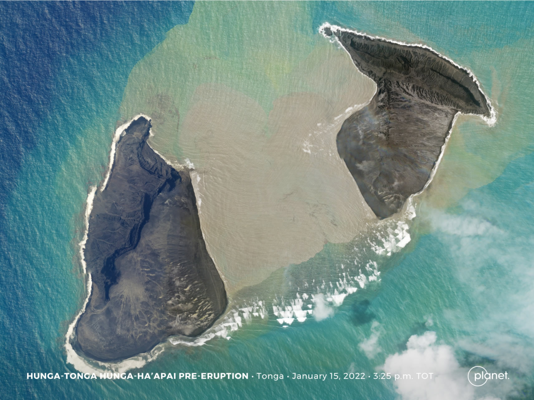
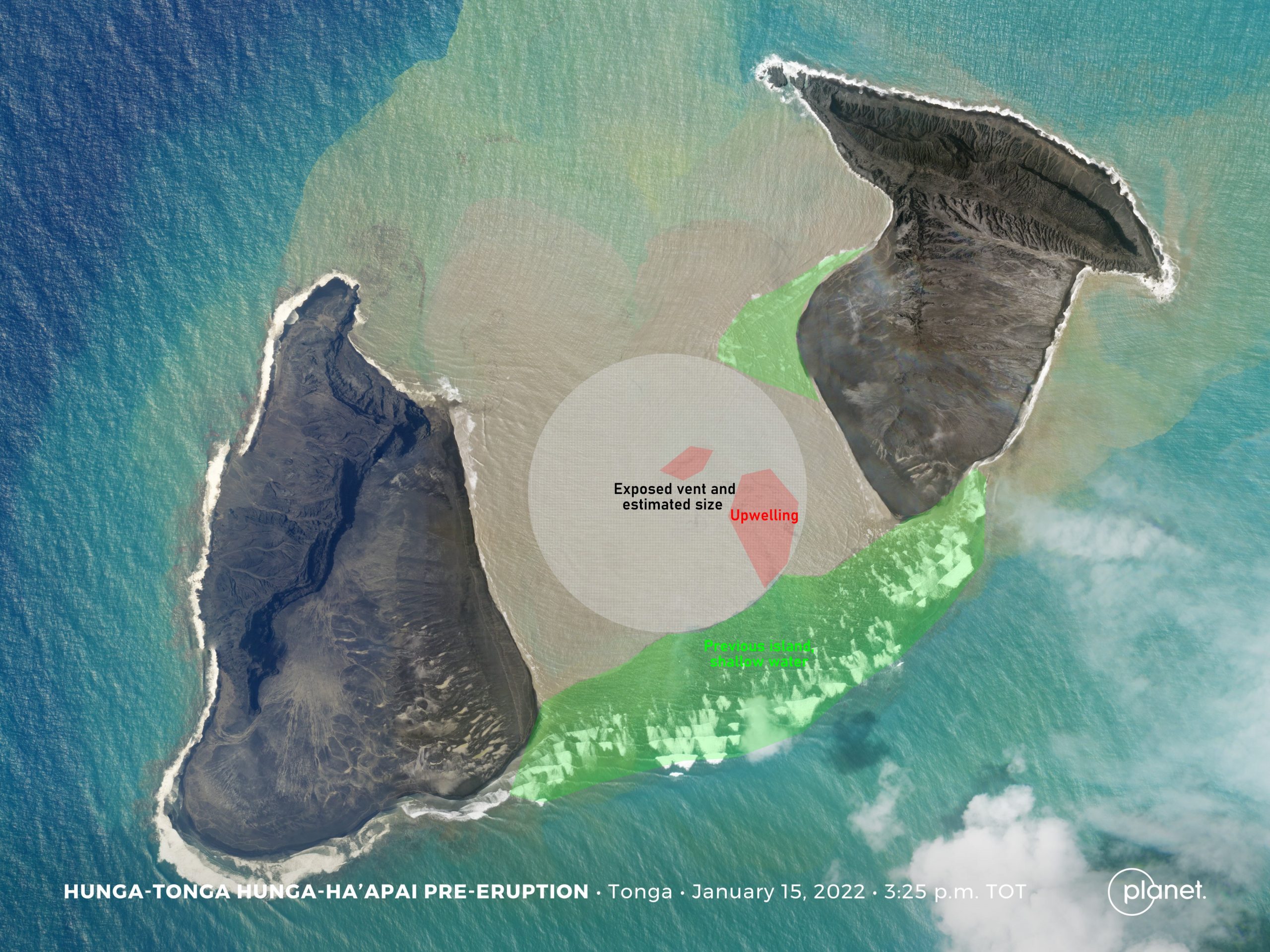
Whilst not confirmed at this stage, this tsunami could have been the result of the central part of the island collapsing into the ocean as shown in this Planet satellite image.
Source: Planet.com
Basic analysis of this image suggests that only a small amount of the above water mass was removed, likely due to the eruption displacing this. Detailed on-site mapping would be required to confirm what happened underwater. There are also signs of upwelling in the vent. The flooding on the vent may have made things more unstable, setting in motion a much bigger eruption.
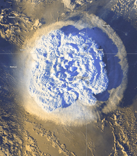
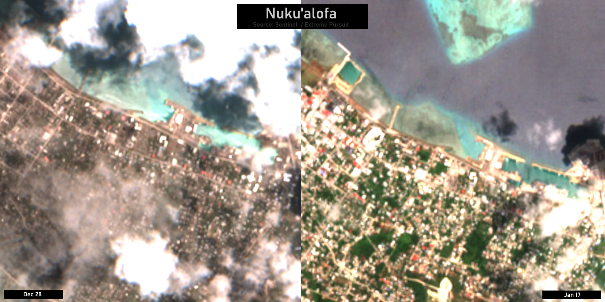
Just two hours after this image was taken, Hunga Tonga-Hunga Haʻapai exploded in spectacular fashion. At 5:10pm local time on 15 January, a massive explosion occurred sending an ash column to over 30km and creating a pressure wave that travelled around the globe multiple times at more than 1000 kilometres per hour. The resulting sonic boom was heard in Fiji, Australia, New Zealand and even in Alaska, over 9000 kilometres away. A destructive tsunami was also produced that reached 15 meters high in Tonga, swamping some smaller islands of Ha’apai and impacting the capital Nuku’alofa. The tsunami impact stretched across the Pacific, striking the coastlines in Fiji, Vanuatu, American Samoa, New Zealand, Japan, the US and Peru.
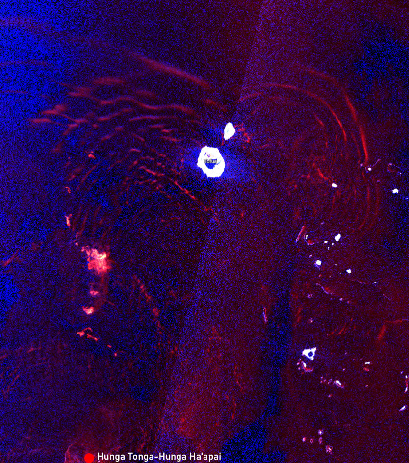
Tsunami waves caught on satellite (Source: Sentinel-1)
Sentinel-1’s radar imagery confirmed that the 2014/15 eruptive island was all but gone and the original Hunga Tong and Hunga Ha’apai Islands were still standing, but significantly smaller.
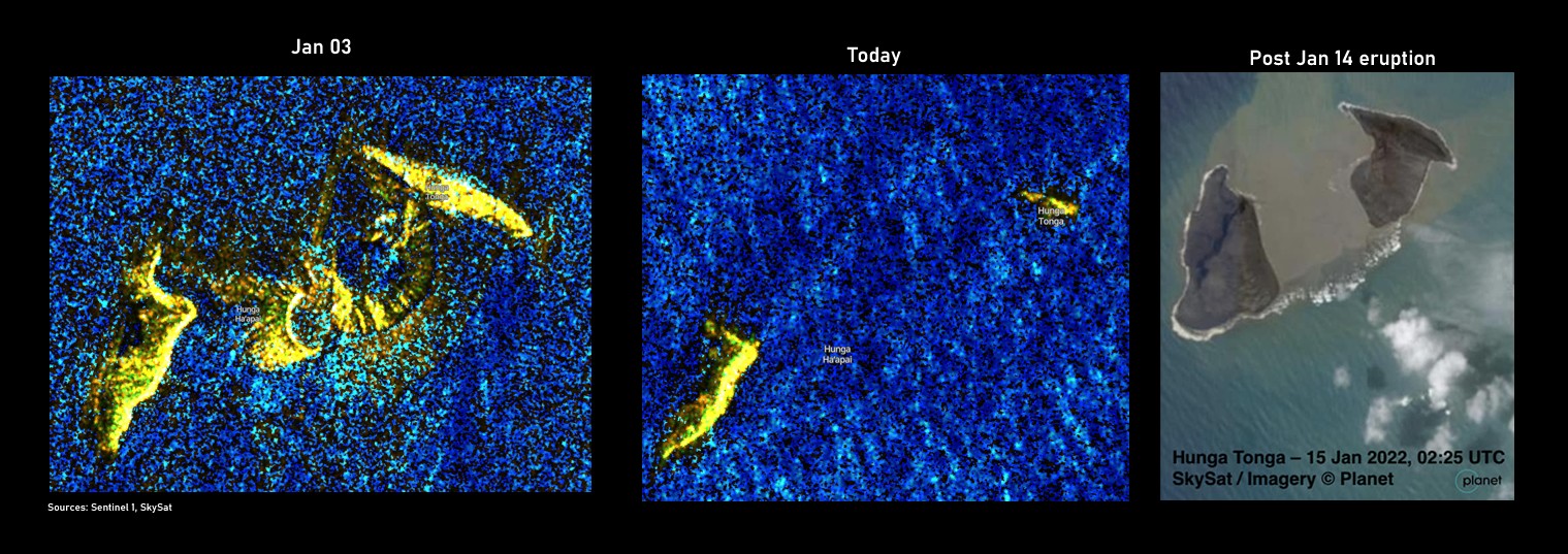
Source: Sentinel-1, SkySat / Planet
True Colour imagery from Sentinel-2 also confirmed this. Pumice rafts and a discoloration of water around the eruption site were also observed.


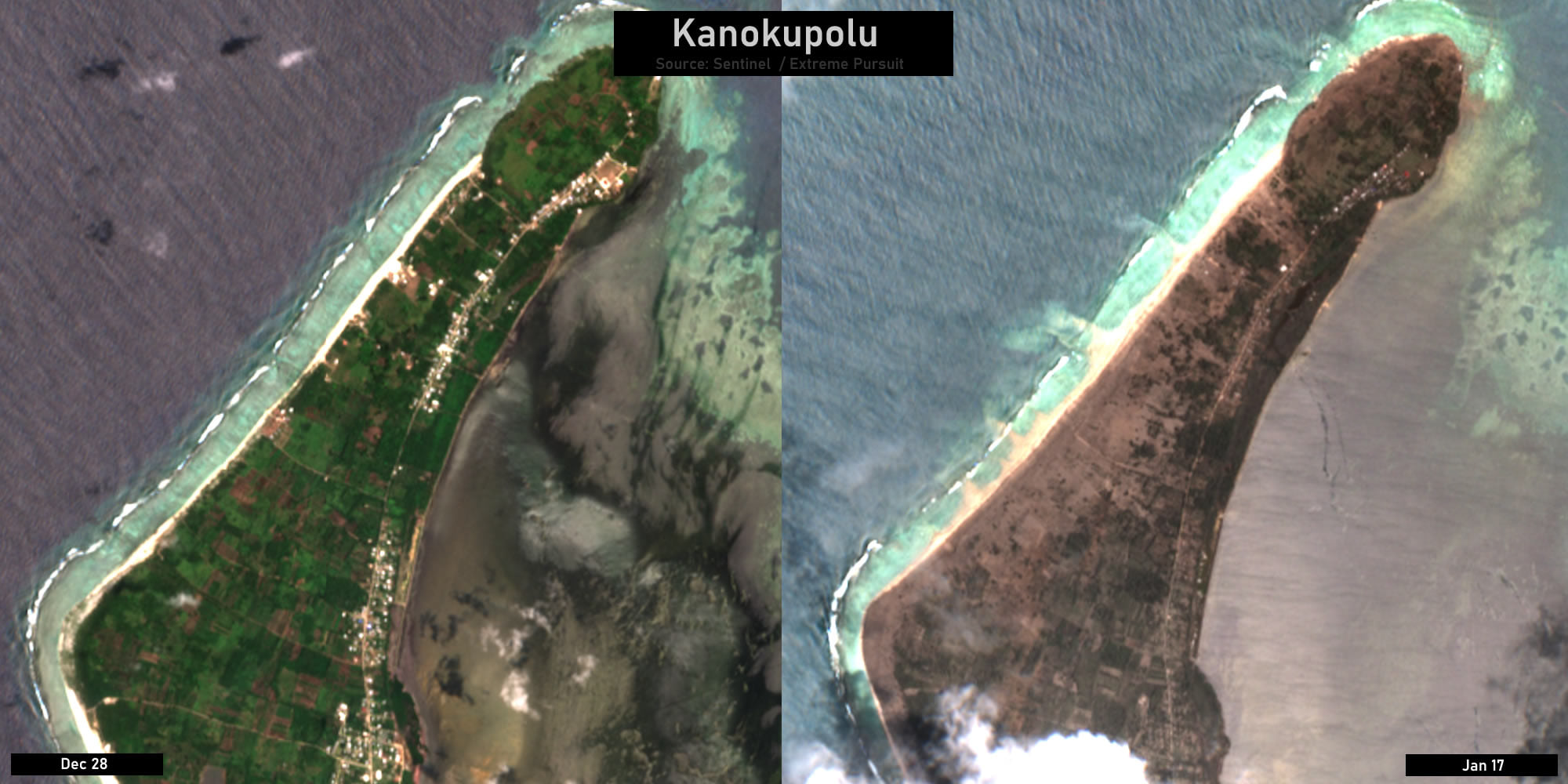
Ash and lapilli fell across Tongatapu and the Ha’apai islands, turning what was lush green fields and forest into a barren wasteland.
This eruption was an historic one, and possibly the largest since Pinatubo in 1991. Early estimates have it as a VEI 4 or 5. There is much to unpack here and so many unknowns. Scientists will be studying this event for many years to come. Whilst it is easy to come to early conclusions, the reality is that no one fully understands what happened. I have however provided a few thoughts and theories below and have shared some analysis.
The Eruption
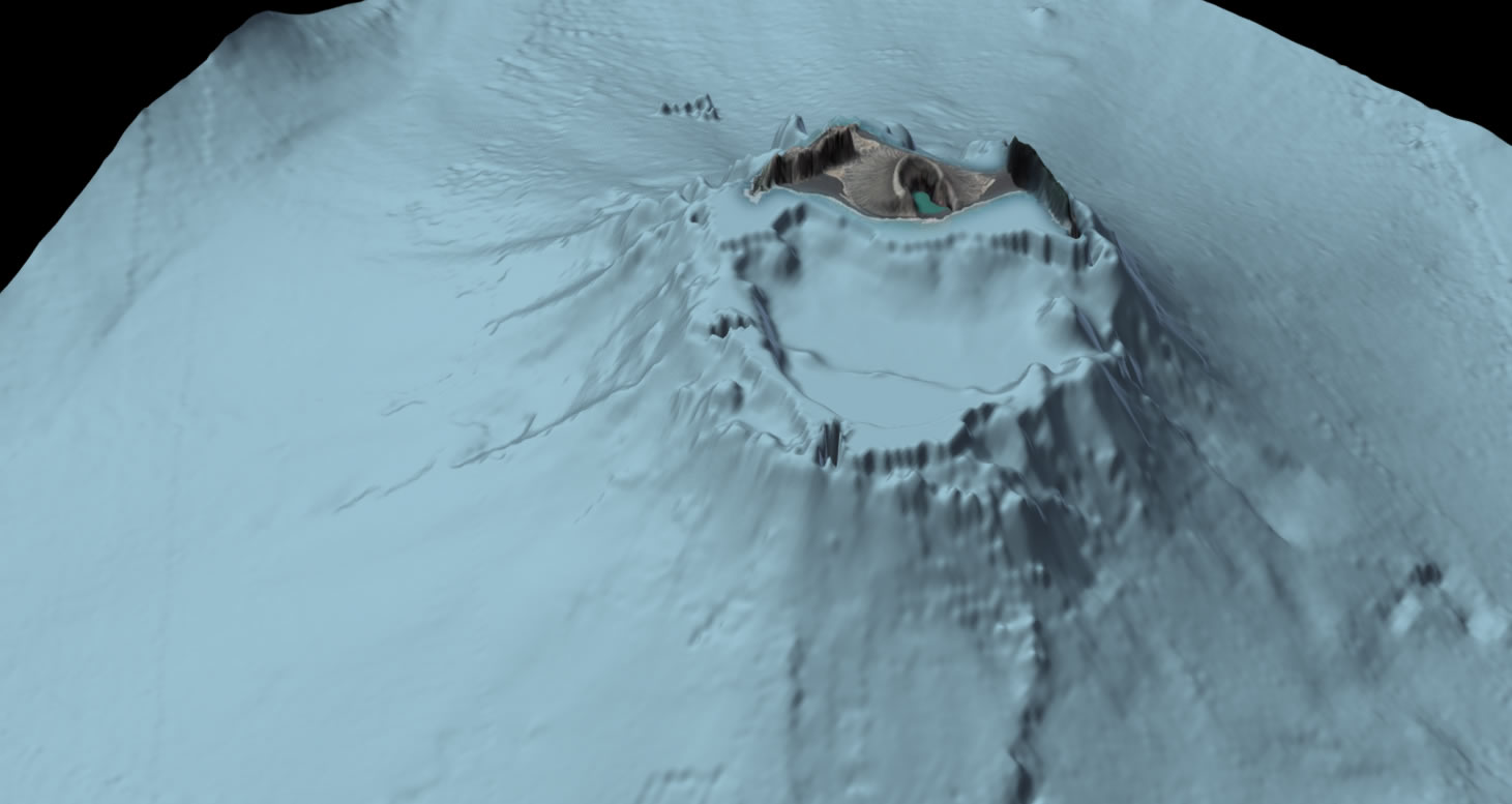
Before we can understand the eruption, we need to understand the volcano and more importantly, what lies beneath the ocean’s surface. Hunga Tonga-Hunga Haʻapai rises 1800m high, with its summit being the Hunga Tonga and Hunga Ha’api Islands. The past five eruptions (not including the Jan 15 one) have occurred around the caldera rim, including the 2014/15 eruption that created a new island and connected the two existing islands. Just south of this island lies the caldera, which extends 5km and is approximately 150-200m deep.
Eruptions in late 2021 added a significant amount of additional land to the island’s southern end and was perched right beside the caldera cliff face. This made the section highly unstable and prone to collapse. Hours before the Jan 15 eruption, satellite imagery confirmed the middle section of the island had disappeared, but the amount of mass shifted could have been limited due to the apparent shallow water around the vent site. Whether there was a large collapse or simply a section destroyed by the smaller Jan 14 eruption is still a big unknown. What is known is that a small 30-40cm tsunami was generated. The Jan 14 eruption was unlikely to be big enough to generate a volcanic tsunami through an explosion alone and so a collapse is more probable. The Jan 14 eruption may have only created a partial collapse and subsequently made a much larger mass even more unstable. The eventual collapse may have exposed the conduit (possibly already inundated with water through the submerged vent) with an explosive fallout.
It is also possible that the Jan 15 eruption was a caldera eruption involving massive amounts of new magma that slowly replenished over a period of a thousand years, interacting in spectacular fashion with the sea water.
Source: vizualism
The Tsunami
There are many unknowns as to what caused the tsunami – including whether it was part of the volcano collapsing into the water, or an explosion underwater, the pressure wave or a combination of these. There are also suggestions that there were meteotsunamis produced as a result of the pressure wave.
I will share new scientific findings as they are published.