
Few places on Earth feel as primal as Ambrym. This remote volcanic island in Vanuatu’s Malampa Province is dominated by a formidable active volcano whose presence shapes everything about the island. Getting there is not easy, and reaching the volcano itself is harder still, requiring serious commitment, physical endurance, and the help of experienced local guides. But for those willing to make the effort, Ambrym delivers something few destinations can. A raw, unfiltered encounter with the forces that built our planet.
This guide covers the essentials for a trip to Ambrym: how to get to there, where to find a bed on an island with no hotels, and the reality of trekking into a 12-kilometer volcanic caldera.
The ash plain and Benbow cone…on a very rare blue sky day.

Active Volcano: Know the Risks
When visiting an active volcano, it is vital to understand the inherent dangers. These are volatile environments that can erupt without warning. Volcanic activity poses significant risks, including the potential for severe physical harm or even death.
Safeguarding your trip to the Ambrym caldera starts with checking the Vanuatu Meteorology and Geohazards Department (VMGD) bulletins. As of now, Ambrym remains at Alert Level 2 (Major Unrest). Because these volcanoes can shift from “unrest” to “eruptive” with little to no warning, the VMGD’s real-time data is the only reliable way to know which areas are safe to enter.
Following their advice – and that of your local guides. If the VMGD raises the Alert Level or identifies a specific exclusion zone (typically a 2km radius around active vents), do not attempt to bypass it.
What to pack
When packing for Ambrym, you have to prepare for two completely different worlds. Firstly, the sweltering, humid jungle at the base and the cold, wind-blasted volcanic plateau at the top. Because you’ll be carrying your own gear (unless you hire an extra porter), keeping your pack light but functional is the ultimate balancing act.
- Footwear: Sturdy, broken-in hiking boots are non-negotiable. The ash plain is actually made of abrasive volcanic scoria that will shred thin sneakers, and the jungle trails can be incredibly slick with mud.
- Clothing: Pack lightweight, moisture-wicking clothes for the climb. However, once you reach the caldera, the temperature drops significantly, especially at night. Bring a high-quality windbreaker or rain shell and a warm fleece or lightweight down jacket for camping. Skip the shorts and stick to long trousers. The jungle trails are home to plenty of biting insects (like ticks) that will make short work of exposed skin. See the “Staying healthy” section.
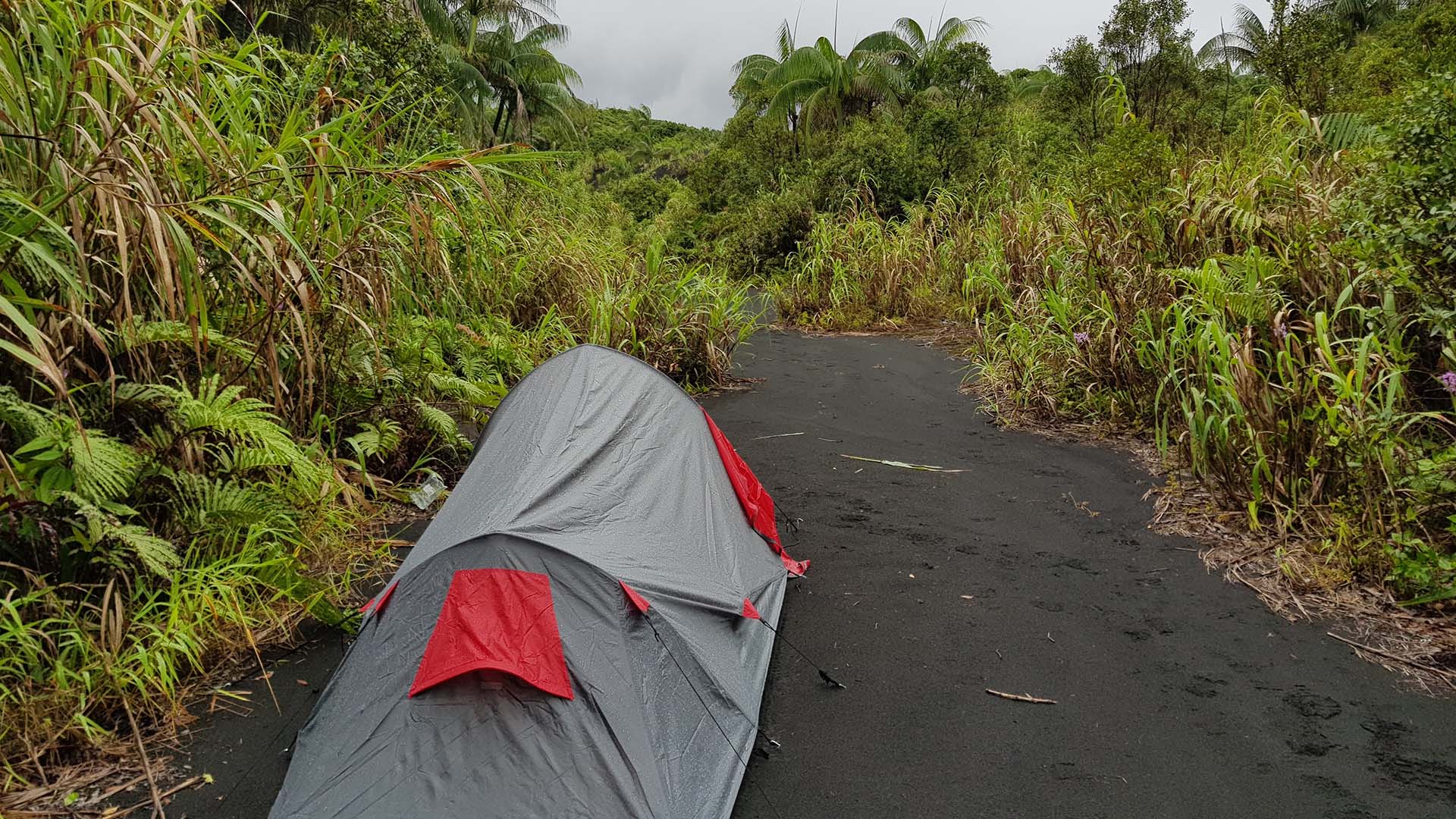
- Sleeping: A lightweight tent with a good flysheet is essential, as rain on the volcano can be horizontal and relentless. A thin sleeping mat and a sleeping bag rated for at least 10 degrees C.
- Hardware: A reliable headlamp with extra batteries is critical for navigating the camp at night or doing a sunrise trek to the crater edge. Don’t forget a power bank, as there is nowhere to charge devices once you leave the village.
- Food & Snacks: Pack plenty of high-energy snacks like trail mix and energy bars from Port Vila, as the tiny village shops only carry basic staples and food provided on the trek itself is often minimal or non-existent. (see Food & Eating)
Always pack your gear in heavy-duty dry bags, as Ambrym is notorious for sudden, torrential rainfall that can soak through a standard backpack in minutes.
Getting to Ambrym
Post-Air Vanuatu’s collapse, the airline has finally settled into a semi-reliable twice-weekly schedule to Ambrym, typically running on Tuesdays and Saturdays. These 45-minute Twin Otter flights jump from Port Vila straight to Craig Cove on the island’s western side, but don’t get too attached to the departure time. In Vanuatu, schedules are more like a best-case scenario, and you should definitely keep an eye on the Air Vanuatu website for last-minute shifts.
Forget instant online booking. You have to submit a manual request through the Air Vanuatu website and wait for a human to ticket it, or physically walk into their sales office in Port Vila.
The landing itself is part of the adventure. You aren’t headed for a paved runway, rather it’s a mowed grass strip. This means if there’s been a heavy tropical downpour, the ground becomes too soft for a safe landing and your flight is likely getting canceled or diverted. You have to stay flexible. Between the weather and the occasional mechanical hiccup, delays are just part of every day life.
If you’re short on time and have a deeper pocket, there are a handful of private operators that offer chartered flights from Port Vila or Santo (Unity, Air Taxi). These will drop you directly at Craig Cove or even Ulei on the eastern side. It’s significantly more expensive, but it’s the only way to guarantee you’ll be on the ash plain according to your own timeline.
The white-knuckle approach to the Craig Cove airstrip.

Once you’ve landed
When you land at Craig Cove, don’t expect a terminal or a baggage carousel. The “airport” is essentially a mowed grass field and small building that serves as the waiting area, and usually, the entire village shows up to see who (and what) is arriving.
Once you’ve grabbed your bags off the plane, you’ll need to sort out a ride to your guesthouse. Most of the time, your host will have a truck waiting for you if you’ve coordinated ahead of time. Don’t expect a taxi sedan here; every vehicle on the island is a rugged 4WD truck, and you’ll usually be hopping into the back alongside locals, crates of produce, and the occasional chicken. It’s a bumpy, open-air introduction to island life, but if you’ve booked a spot right in Craig Cove, it’s often easier to just shoulder your pack and make the short walk to your accommodation.
If you’re heading to the north of the island (typically Ranon or Ranvetlam), forget the road. There isn’t one that connects the west to the north, so your only real option is to hop on a local boat. It’s about a two-hour trip along the coast, and while the views of the jungle meeting the ocean are incredible, it can get pretty choppy. You’ll be in a small open-topped motorboat, so keep your rain jacket handy and make sure your gear is in a waterproof bag, because you’re almost guaranteed to catch some sea spray along the way.
A plane landing at Craig Cove draws a crowd every time.

Truck transfer from Craig Cove to Port Vatu

Where to stay
Most travelers base themselves in the West or South-West, as it’s the most direct gateway to the craters. If you’re sticking close to the airstrip, Sam’s Guesthouse in Craig Cove is a solid, reliable choice.
However, if your main goal is to keep the hike as manageable as possible, you’ll want to head about an hour’s drive down the coast to the village of Port Vato. We strongly recommend staying there with John Tasso at Vanuatu Island Experience. We’ve partnered with John on over 20 expeditions to Ambrym, and he’s easily one of the most seasoned guides on the island. You can check out his site and get in touch with him here.
Since most of these spots aren’t on major booking sites, you’ll need to reach out directly to secure a bed. Don’t expect an instant reply, though internet access on the island is spotty at best, so it can take a few days to hear back. Your best bet is to send a quick email or, even better, a text or WhatsApp message, which usually gets a faster response than a phone call.
The guesthouse bungalow at Port Vatu
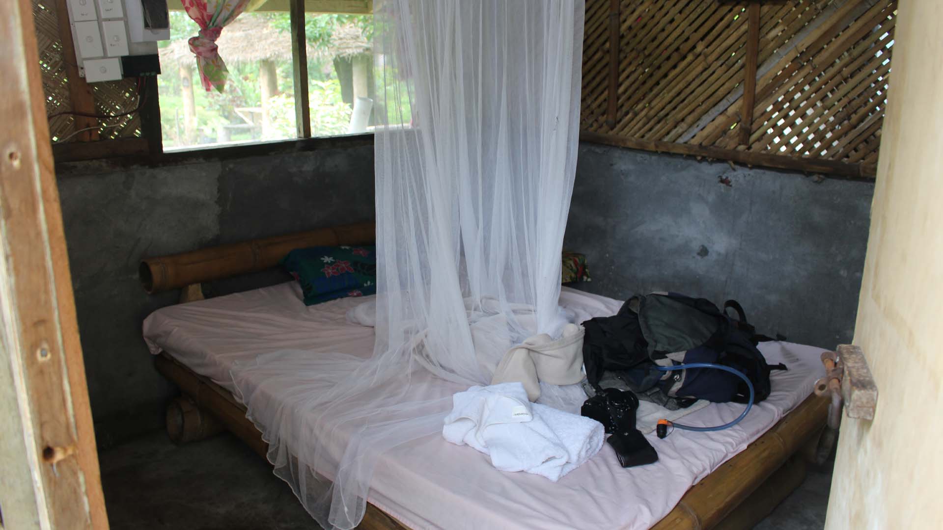
Accommodation expectations
When it comes to staying on Ambrym, you need to recalibrate your expectations. There are no luxury resorts, air conditioning is nonexistent, and “24-hour electricity” usually just means a solar-charged battery that dies shortly after dinner. What you get instead is genuine “Kastom” hospitality in local guesthouses – simple bungalows built from bamboo and palm leaves.
The showers are cold and sometimes you’ll just get a bucket of cold water to wash with.
Food & Eating
Eating on Ambrym is pretty straightforward: you’ll be eating whatever your guesthouse host has prepared for the day. Since restaurants and cafes don’t exist here, you’re looking at a true “island style” menu based on what was harvested from the village garden that morning.
Breakfast is usually a simple, fresh start with local fruit, tea or coffee, and loaves of freshly baked bread. For lunch and dinner, things get a bit more hearty to keep your energy up. You can expect plenty of root vegetables like taro and yams served alongside a protein…usually fresh fish or chicken, though don’t be surprised if tinned tuna makes an appearance in the rotation. These are almost always accompanied by a bush salad and a massive portion of rice.
The one thing you really don’t want to overlook is stocking up on extra food and snacks before you leave the mainland. Once you touch down in Ambrym, your access to variety effectively disappears. This is especially critical if you have any specific dietary requirements, like being gluten-free or vegan. While the local diet is naturally heavy on root vegetables, the concept of specialised ingredients or cross-contamination isn’t part of daily life on the island, so bringing your own base staples is a necessity to ensure you aren’t stuck eating plain white rice for several days.
For the hike itself, you are going to need high-energy fuel that can survive being tossed around in a backpack. We recommend packing your own custom trail mix with nuts, seeds, and dried fruit, as the local village stores generally only carry basic crackers which won’t cut it when you’re burning thousands of calories on the ash plain.
We’ve also learned from over 20 trips to the island is that you shouldn’t count on a catered spread once you leave the village. In our experience, the food provided on the actual trek can be incredibly minimal, sometimes consisting of little more than a small portion of rice or some crackers, and occasionally, there is no food provided at all during the climb. The guides are there to lead you safely through the terrain, not to act as wilderness chefs, so treating the hike as a self-sufficient expedition is the safest bet.
Small village shops offer very limited staples like dry biscuits and tinned tuna, so don’t count on them for trekking supplies or fresh variety.
Hiking towards Benbow in Ambrym’s Caldera

Water and Hydration
Since most villages on the island source their water from roof catchments, local wells, or nearby streams, you should only consume it if you have a reliable filtration system or purification tablets. To be completely safe, we highly recommend purchasing enough bottled water from the small shops on the island to last for your entire trip, including the trek itself. Having a sealed, dependable supply from the moment you arrive until the moment you fly out is the best way to avoid stomach issues and stay properly hydrated in the intense tropical heat.
You need to carry your entire water supply for the duration of the trek, as there are no reliable sources once you leave the village. Be mindful of your bottles during the climb; while the guides and porters are incredibly hardworking, they often don’t bring enough water for themselves and may drink from your stash.
Staying Healthy
Staying healthy on Ambrym is mostly about prevention, as medical facilities on the island are extremely basic and the nearest pharmacy is a flight away in Port Vila. While the island is a paradise, the tropical environment requires a bit of tactical preparation.
Malaria – Vanuatu is a malaria-risk area, and Ambrym’s dense, humid jungles are prime territory for mosquitoes. Since you’ll be trekking through thick vegetation and camping near the caldera, malaria prophylaxis is strongly recommended. Consult your doctor before you leave. Beyond pills, your best defense is a high-DEET repellent and wearing long trousers and sleeves, especially at dawn and dusk.
Ticks – One thing you absolutely cannot avoid on Ambrym is the ticks. They are everywhere…hiding in the dense jungle foliage and even lurking around the campsites on the ash plain. Based on our experience, it’s not a matter of if you’ll find one on you, but when. You should expect to pick up at least a few during the course of your trek. Because they are so prevalent, performing regular tick checks on your body and clothing is a mandatory ritual. We often keep an eye on the legs whilst trekking. To minimize the hitchhikers, keep your trousers tucked into your socks and apply a strong DEET-based repellent to your gear and lower legs before hitting the trail.
Food-Borne Illnesses – While the guesthouse food is generally fresh and organic, your stomach might not be used to the local microbes. To avoid “island belly,” stick to the golden rule of remote travel: if you can’t peel it, boil it, or cook it, leave it.
Protection from the Elements –The ash plain offers zero shade, and the volcanic scoria reflects heat like an oven. A wide-brimmed hat, high-SPF sunscreen, and polarised sunglasses are mandatory to avoid severe sunburn and windburn.
The incredible crater of Benbow

Money and expenses
There are no ATMs on the island, so bring cash with you and only the local vatu currency.
Prices vary by location and host. Use these estimates as a guide, but be prepared for some variation in actual costs.
- Transport: Transportation represents the largest single cost of your trip. Local drivers must account for high diesel prices, so expect to pay roughly 7,000 vatu ($60 USD) for a one-way truck transfer from the airport to Port Vatu (includes all passengers).
- Accommodation: Expect to pay around 3,000 vatu per night for a basic bungalow. Camping is usually half this amount.
- Meals: Budget around 3,000 vatu per day for your meals.
- Volcano Trek: For a 2 day (one night camping) trek, including a guide will set you back around 15,000 vatu per person ($130 USD). Porters are also available for 5,000 vatu.
The weather
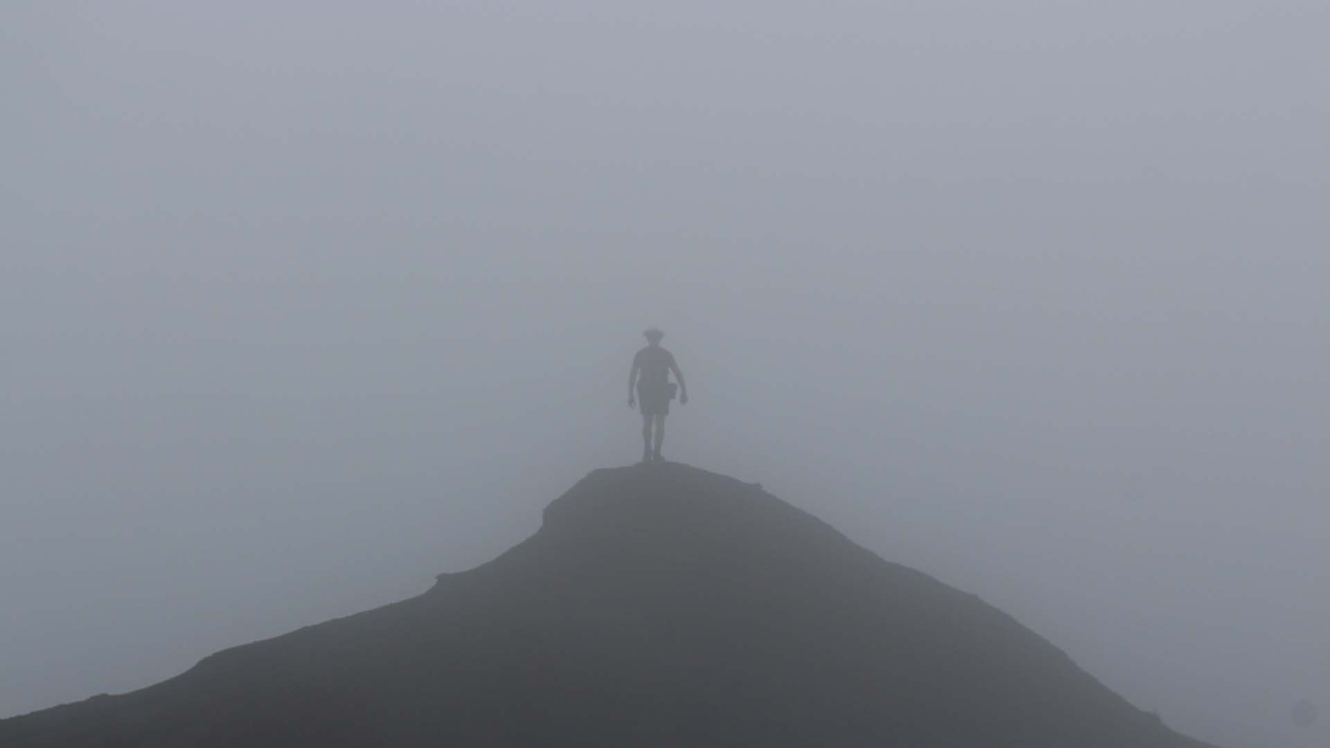
The weather on Ambrym covers everything extreme. It’s often a sweltering, humid heat in the villages and jungle, but as you emerge onto the caldera, the temperature drops sharply and the wind-chill becomes biting. It is common for the coastal villages to enjoy a perfect sunny day while the caldera remains trapped in its own microclimate of torrential rain and thick, disorienting fog. Because the volcanic peaks draw in moisture and volcanic gases, visibility can vanish in minutes, leaving the ash plains dangerously cold and wet even when it is a tropical paradise at sea level.
Total white-out conditions are normal
The trek up the volcano
Attempting Ambrym without a local guide is dangerous and a breach of kastom. The jungle is a labyrinth of mud and roots, while the featureless ash plain can be erased by sudden, disorienting fog. Beyond navigation, all land is village-owned; trekking solo is considered trespassing on sacred ground. Your guide is your essential lifeline, ensuring you avoid unstable crater rims and respect the mountain’s strict local taboos.
No matter which village you choose as your starting point, your journey begins with pristine, humid jungle. The vegetation is straight out of a prehistoric film. You’ll be hiking through a dense, green wall of giant tree ferns and tangled vines that thrive in the rich volcanic soil. It’s hot though because the canopy traps the heat and blocks any breeze.
This initial leg usually takes around 5-6 hours. The trails are often on overgrown, winding tracks of slick mud and tangled roots that requires constant focus to avoid slipping. As you push higher through the dense jungle, the trail becomes increasingly rugged, with sections where you’ll be climbing directly up and over old lava flows.


Once you finally punch through the last of the dense vegetation, you’ll find the base camps perched right on the fringe where the jungle gives way to the caldera.
Leaving the shelter of the camp, you step directly onto the 12-kilometer ash plain, a vast, gray lunar landscape that feels like another planet. You’ll also get your first view of the two imposing cones of Marum and Benbow.
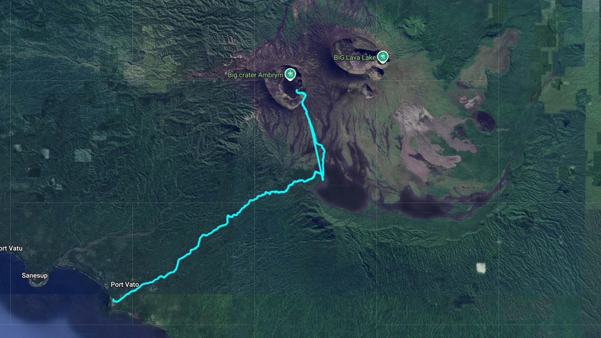
Before the 2018 eruption, a network of tracks crisscrossed the ash plain, making it easy for trekkers to visit both cones or even cross the entire island in one go. That’s no longer the case. The landscape has shifted so much that those old routes are gone, and access is now limited. If you have your sights set on Benbow, you’ll need to plan your approach specifically from the southwest, starting from villages like Port Vatu or Craig Cove.
Access to Marum is currently limited to the northern routes, such as those starting from Ranvetlam or Endu. However, during our last visit, local reports suggested that even these northern paths have become impassable. We’re planning to lead an expedition soon to scout the terrain and see if we can establish a reliable new route to Marum from the south.
For the time being, we strongly recommend approaching the trek from the south. This route is your best bet for guaranteed access to Benbow and Niri Taten, an incredible collapse pit where you can see the dark, twisted formations of recent lava flows up close.
Our route from Port Vatu up to Benbow
Campsites
Several campsites once lined the caldera’s edge, but a series of cyclones has since reclaimed most of them. These days, we typically pitch our tents at West Camp. Though it formerly had a bungalow, a toilet, and a water tank, those amenities are long gone. All that remains is a bit of level ground and a scattering of rusted pots and pans. Without a toilet left, you’ll need to find a private area and bury your waste.
What’s left of West Camp
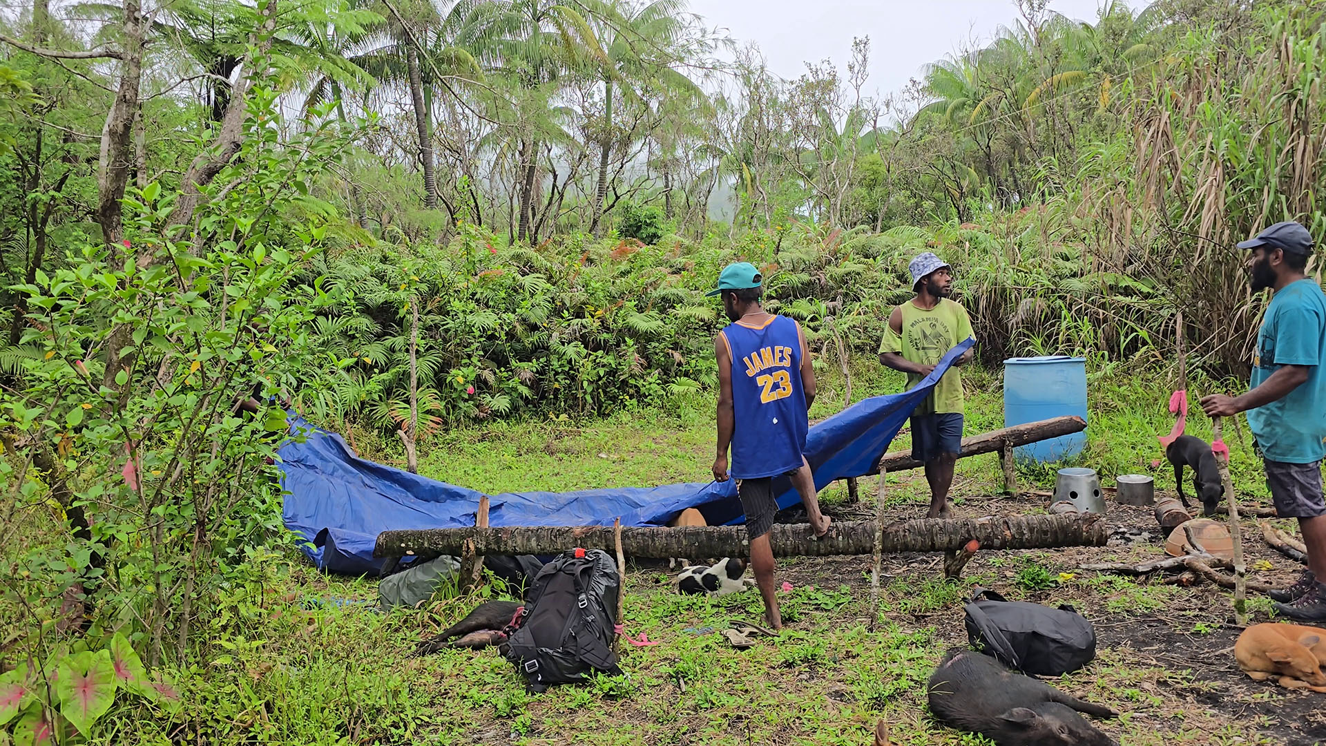
Camping at West Camp
The volcano and its cones
Benbow
Benbow is the westernmost of the two main volcanic peaks and is often the first summit hikers tackle after leaving West Camp. It’s a steep, leg-burning ascent over crumbly volcanic ash. The final ridge is notoriously narrow – sometimes only half a meter wide. with dizzying drops on both sides. Benbow’s crater is deep and rugged. While the permanent lava lakes of the past were buried in the 2018 collapse, recent activity has brought fresh lava flows back into the crater floor. It is a place of sometimes loud, violent degassing and steam.
While it was once possible to descend into the first tier of the crater and reach the inner ash plain, that route is no longer possible. The terrain has become treacherous with extremely steep, uneven, and prone to crumbling terrain. Since the collapse of the inner tephra ring, the ash plain below has been heavily scarred by erosion. Perhaps more importantly, recent lava flows have begun to cover the plain which is a volatile new development that makes any descent a massive risk. In short: do not even attempt it.

Marum
Hiking to Marum is often considered the centerpiece of an Ambrym expedition, though it is arguably the most demanding trek within the caldera. However, since the 2018 eruption and subsequent crater floor collapse, Marum has become essentially inaccessible. What was once a relatively manageable trek to a series of spectacular viewpoints has been transformed into a treacherous landscape of vertical cliffs and crumbling rock. The surrounding rim is now extremely unstable, with massive overhangs that can give way without warning.
Access from the north may have been an option in the past, but our latest local reports indicate that this path is now impassable as well.

Other Craters
Mbogon Niri Mbwelesu (Taten)
Situated just east of Benbow, this dramatic collapse pit is accessible from the southern side of the island only and is an excellent addition to a Benbow trek. The 2018 eruption fundamentally reshaped this site, triggering a massive failure of the northern wall that nearly doubled the pit’s diameter. Today, the crater floor is marked by a fresh lava flow, while the walls display a vibrant spectrum of volcanic minerals, making it arguably the most picturesque location within the entire caldera.
Extreme caution is required here: Do not approach the absolute edge of the crater. The rim is exceptionally unstable, and sudden landslides or edge collapses are frequent and unpredictable.

Niri Mbelesu
Locally referred to as the “son” or “nephew” of the larger volcanoes, this smaller crater saw some of the most dramatic changes during the 2018 eruption. Before the 2018 collapse, Niri Mbelesu briefly hosted a spectacular new lava lake. Unfortunately, it’s no longer accessible and there isn’t much to see either. The crater has extremely steep walls with regular rockfalls.

The Lava Lakes
If you’ve been researching Ambrym, you’ve likely seen spectacular footage of its churning lava lakes. Unfortunately, those iconic features are a thing of the past.
Following the massive 2018 eruption, the iconic lava lakes of Benbow and Marum completely drained and are no longer active. The magma levels dropped suddenly, causing the crater floors to collapse inward and burying the open lava pits under millions of tons of rubble. While the volcanoes remain at Alert Level 2 (Major Unrest), the permanent churning lakes have been replaced by deep, volatile collapse pits and occasional short-lived flows, permanently altering the caldera’s landscape.
The former lava lake at Marum – Photo taken in 2016
