- Home
- /
- Global Volcano Database
- /
- Philippines Volcanoes
- /
- Mount Pinatubo
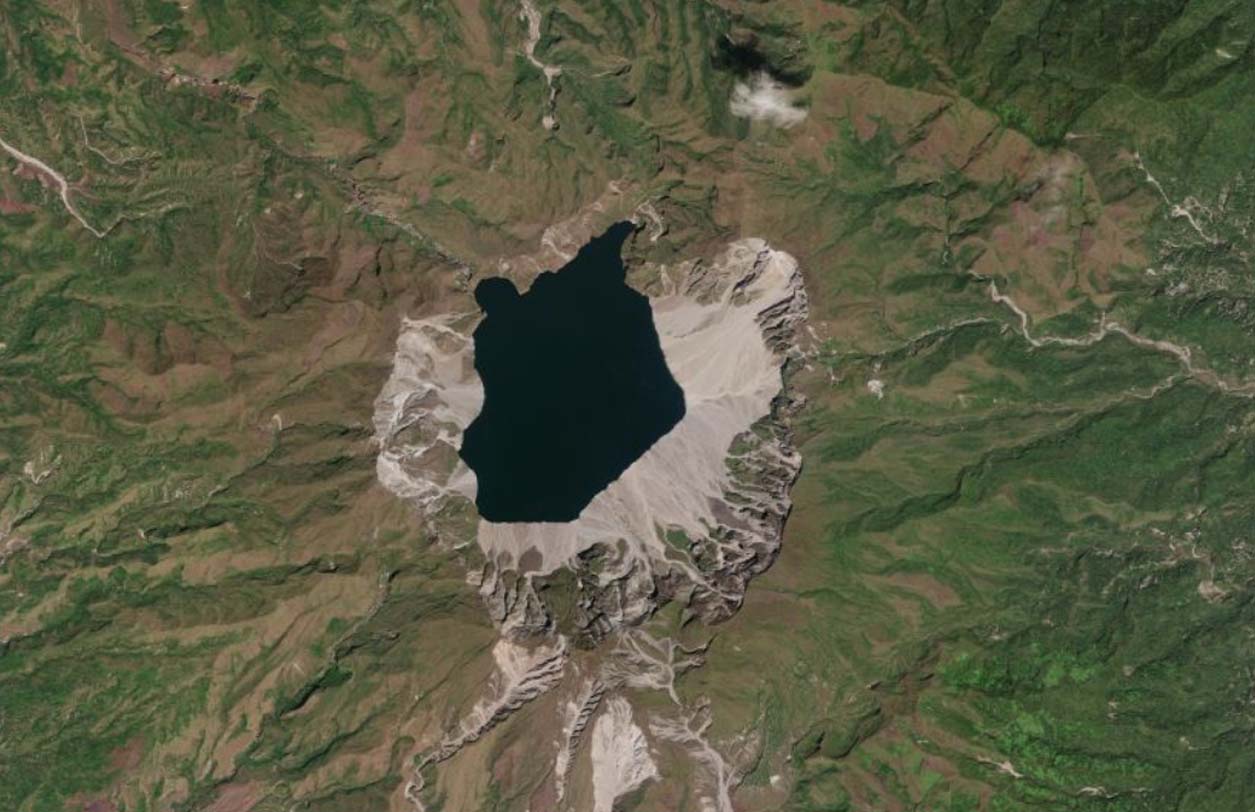
Pinatubo is an active stratovolcano situated in the Zambales Mountains, Philippines. It was not known for any eruption until its 1991 destructive eruption that produced the second-largest terrestrial eruption of 20th century.
| Location: | Philippines |
| Coordinates: | 15.143581, 120.349428 |
| Volcano Type: | Stratovolcano |
Mount Pinatubo’s Location
Mount Pinatubo Latest Status
2026: Alert Level 1 – Not Active.
Mount Pinatubo’s Eruptive History
| 1991 | March – a series of volcanic earthquakes occurred, causing steam explosions on the N flank. From April through June, seismicity continued, with thousands of small earthquakes recorded. Gas emissions also steadily increased. Come June, Magma reached the surface, forming a lava dome. The first eruption occurred on June 12 with a cataclysmic eruption following on June 15. This eruption produced a massive ash column reaching 35km. More than 5 cubic kilometers of material was ejected. The summit collapsed, creating the caldera (which is now a lake). |
| 1992 | Pinatubo erupted again, destroying 10,000 homes. |
| 2020 | Phivolcs denies Pinatubo unrest after strong Luzon quake. Locals reported Pinatubo was emitting smoke. This was down to landslides as a result of the earthquake. |
| 2022 | A phreatic eruption occurred at Pinatubo producing a small steam plume. |
Mount Pinatubo Monitoring
Please refer to PHIVOLCS for all of the Philippines Volcano Monitoring.
Mount Pinatubo Images
- Home
- /
- Global Volcano Database
- /
- Philippines Volcanoes
- /
- Mount Pinatubo